Near Middletown in Frederick County, Virginia — The American South (Mid-Atlantic)
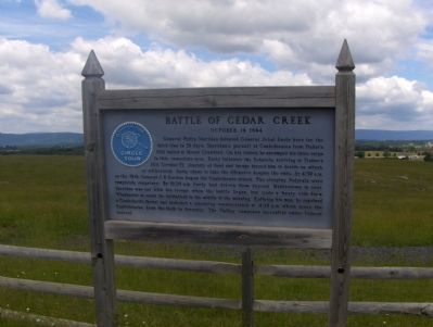
Battle of Cedar Creek
October 19, 1864
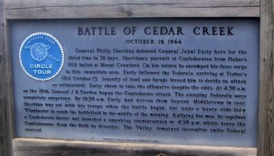
Photographed By Roger Dean Meyer, June 3, 2006
1. Battle of Cedar Creek Marker
A Virtual Tour of the Battle of Cedar Creek by HMDb Markers
Click for more information.
Click for more information.
General Philip Sheridan defeated General Jubal Early here for the third time in 30 days. Sheridan’s pursuit of Confederates from Fisher’s Hill halted at Mount Crawford. On his return he encamped his three corps in this immediate area. Early followed the Federals, arriving at Fisher’s Hill October 13. Scarcity of food and forage forced him to decide on attack or withdrawal. Early chose to take the offensive despite the odds. At 4:30 a.m. on the 19th, General J. B. Gordon began the Confederate attack. The sleeping Federals were completely surprised. By 10:30 a.m. Early had driven them beyond Middletown in rout. Sheridan was not with his troops when the battle began, but made a hasty ride from Winchester to reach the battlefield in the middle of the morning. Rallying his men, he repulsed a Confederate thrust and launched a smashing counterattack at 4:30 p.m. which drove the Confederates from the field in disorder. The Valley remained thereafter under Federal control.
Erected 1964 by Virginia Civil War Commission.
Topics and series. This historical marker is listed in this topic list: War, US Civil. In addition, it is included in the Battlefield Trails - Civil War series list. A significant historical date for this entry is October 19, 1864.
Location. 39° 1.127′ N, 78° 17.637′ W. Marker is near Middletown, Virginia, in Frederick County. Marker is at the intersection of Valley Pike (U.S. 11) and Belle Grove Road, on the right when traveling south on Valley Pike. Touch for map. Marker is in this post office area: Middletown VA 22645, United States of America. Touch for directions.
Other nearby markers. At least 5 other markers are within walking distance of this marker. A different marker also named Battle of Cedar Creek (about 400 feet away, measured in a direct line); Heater House (about 500 feet away); Vermont at Cedar Creek (about 500 feet away); a different marker also named The Battle of Cedar Creek (about 500 feet away); N.C. Troops at Cedar Creek (about 500 feet away). Touch for a list and map of all markers in Middletown.
More about this marker. One of the series of Shenandoah Valley Circle Tour markers.
Regarding Battle of Cedar Creek. The Cedar Creek battlefield is interpreted by several markers. See the Battle of Cedar Creek Virtual Tour by Markers link above.
Related markers. Click here for a list of markers that are related to this marker. Virtual Tour by Markers of the Battle of Cedar Creek.
Also see . . . Battle of Cedar Creek. National Parks Service summary of the battle. (Submitted on November 5, 2007, by Craig Swain of Leesburg, Virginia.)
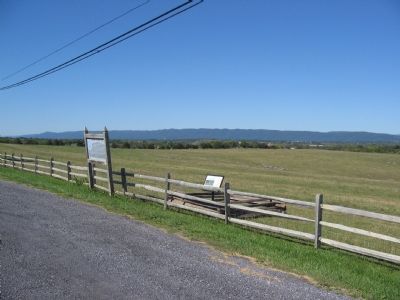
Photographed By Craig Swain, September 29, 2007
3. The Pulloff for the Circle Tour Marker
Confederate Gen. Gordon's Division smashed through Federal lines in this vicinity in the morning phase of the battle. Later in the day, Federal forces pursued the retreating Confederates up the Valley Pike past this location.
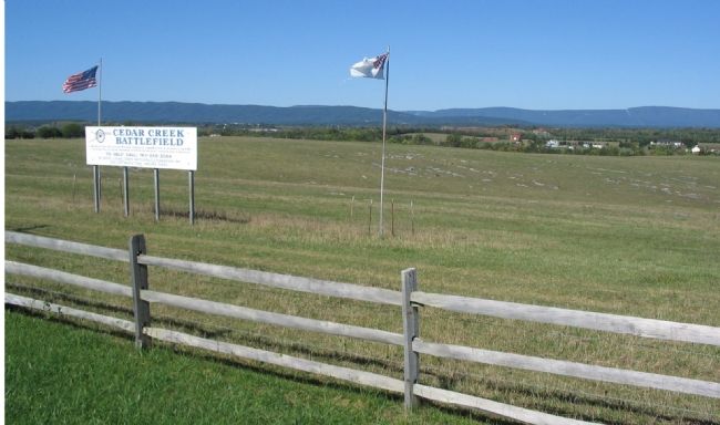
Photographed By Craig Swain, September 29, 2007
4. Cedar Creek Battlefield
In the morning phases of the battle, between 6 and 7 a.m., portions of the Federal VIIIth Corps under Brig. Gen. George Crook rallied in the fields here before Gordon's Confederate Division drove them further west and north of Middletown.
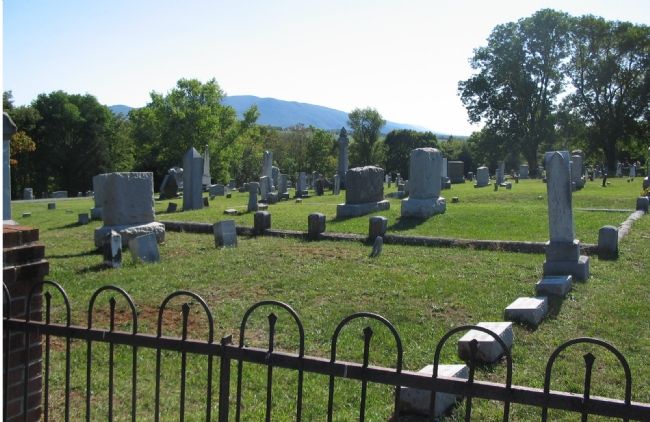
Photographed By Craig Swain, September 29, 2007
5. Middletown Cemetery
Listed as stop nine on the Center of Military History staff ride, the cemetery was at the time of the battle part open field. Getty's Federal Division rallied here and made a stand, allowing the remainder of the Army of the Shenandoah to retreat northward. Federals lay on the reverse slope (to the right side out of frame) of the ridge running through the cemetery, unseen by the advancing Confederates. Pegram's Confederate division advanced within 30 yards (foreground of the photo) without seeing the concealed enemy. The Federals rose and delivered a volley, repulsing the advance. Eventually Confederate artillery placed on the Valley Pike (close to the location of the marker) forced a Federal withdrawal from this point.
Credits. This page was last revised on July 1, 2022. It was originally submitted on October 4, 2006, by Roger Dean Meyer of Yankton, South Dakota. This page has been viewed 2,725 times since then and 37 times this year. Photos: 1. submitted on October 5, 2006, by J. J. Prats of Powell, Ohio. 2. submitted on October 4, 2006, by Roger Dean Meyer of Yankton, South Dakota. 3. submitted on November 5, 2007, by Craig Swain of Leesburg, Virginia. 4. submitted on November 6, 2007, by Craig Swain of Leesburg, Virginia. 5. submitted on November 11, 2007, by Craig Swain of Leesburg, Virginia. • J. J. Prats was the editor who published this page.
