Shingletown in Shasta County, California — The American West (Pacific Coastal)
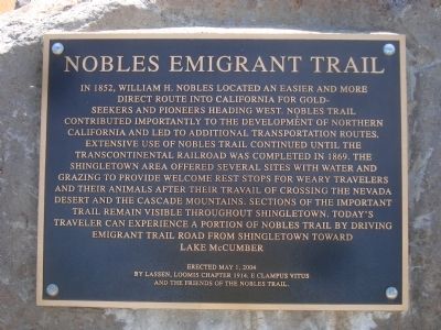
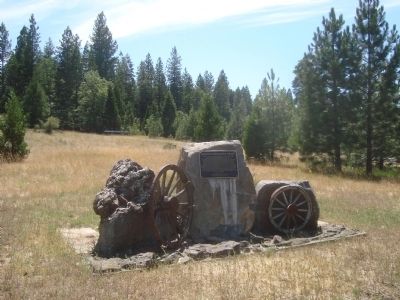
Nobles Emigrant Trail
Erected 2004 by Lassen, Loomis Chapter 1914, E Clampus Vitus and the Friends of the Nobles Trail.
Topics and series. This historical marker is listed in these topic lists: Roads & Vehicles • Settlements & Settlers. In addition, it is included in the E Clampus Vitus, and the Nobles Trail series lists. A significant historical year for this entry is 1852.
Location. 40° 29.499′ N, 121° 53.207′ W. Marker is in Shingletown, California, in Shasta County. Marker is on Alpine Meadows Road just east of Emigrant Trail Road, on the right when traveling south. Touch for map. Marker is in this post office area: Shingletown CA 96088, United States of America. Touch for directions.
Other nearby markers. At least 8 other markers are within 5 miles of this marker, measured as the crow flies. Shingletown Store (about 500 feet away, measured in a direct line); Nobles Trail - Shingletown (about 700 feet away); Noble’s Bungalow (approx. 1.7 miles away); Charlie’s Place (approx. 3.7 miles away); Nobles Trail – Charley’s Ranch (approx. 4 miles away); Manton Store (approx. 4 miles away); Hennessy House (approx. 4.1 miles away); Manton Schoolhouse (approx. 4.2 miles away). Touch for a list and map of all markers in Shingletown.
Also see . . . Nobles Trail - Trails West. From there the trail continued westerly through forested and volcanic country, finally descending to the upper end of the Sacramento Valley at Shasta City. (Submitted on August 7, 2012, by Barry Swackhamer of Brentwood, California.)
Credits. This page was last revised on June 16, 2016. It was originally submitted on August 7, 2012, by Barry Swackhamer of Brentwood, California. This page has been viewed 591 times since then and 19 times this year. Photos: 1, 2. submitted on August 7, 2012, by Barry Swackhamer of Brentwood, California. • Syd Whittle was the editor who published this page.

