Cheat Bridge in Randolph County, West Virginia — The American South (Appalachia)
Shavers Fork
Mountaintop Watershed
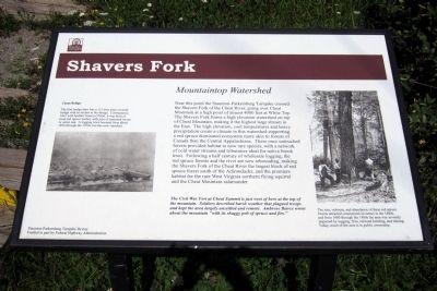
Near this point the Staunton-Parkersburg Turnpike crossed the Shavers Fork of the Cheat River, going over Cheat Mountain at a high point of almost 4000 feet at White Top. The Shavers Fork forms a high elevation watershed on top of Cheat Mountain, making it the highest large stream in the East. The high elevation, cool temperatures and heavy precipitation create a climate in this watershed supporting a red spruce dominated ecosystem more akin to forests of Canada than the Central Appalachians. These once untouched forests provided habitat to now rare species, with a network of cold water streams and tributaries ideal for native brook trout. Following a half century of wholesale logging, the red spruce forests and the river are now rebounding, making the Shavers Fork of the Cheat River the largest block of red spruce forest south of the Adirondacks, and the premiere habitat for the rare West Virginia northern flying squirrel and the Cheat Mountain salamander.
The Civil War Fort at Cheat Summit is just west of here at the top of the mountain. Soldiers described harsh weather that plagued troops and kept the area largely unsettled and remote. Ambrose Bierce wrote about the mountain “with its shaggy pelt of spruce and firs.”
(caption)
The size, richness, and abundance of these red spruce forests attracted commercial investors in the 1880s, and from 1880 through the 1980s the area was severely impacted by logging, fires, railroad building, and mining. Today, much of the area is in public ownership.
Cheat Bridge
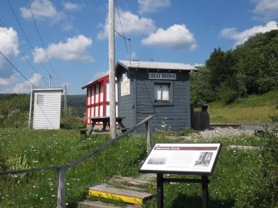
The first bridge here was a 112-foot truss covered bridge with no arches in the design. Contracted in 1841 with builder Francis O’Neal, it was built of local red spruce timber, with pins of seasoned locust or white oak. A logging town boomed from about 1890 through the 1920s, but has now vanished.
Staunton-Parkersburg Turnpike Byway
Funded in part by Federal Highway Administration
Erected by Federal Highway Administration.
Topics. This historical marker is listed in these topic lists: Environment • Horticulture & Forestry • Roads & Vehicles.
Location. 38° 36.699′ N, 79° 52.443′ W. Marker is in Cheat Bridge, West Virginia, in Randolph County. Marker is on County Route 250/4, half a mile west of U.S. 250, on the left when traveling west. Touch for map. Marker is in this post office area: Huttonsville WV 26273, United States of America. Touch for directions.
Other nearby markers. At least 8 other markers are within 2 miles of this marker, measured as the crow flies. Cheat Summit Camp (approx. 0.4 miles away); Asa Gray / Buffalo-Indian Trail (approx. 0.4 miles away); Cheat Summit Fort (approx. 0.8 miles away); Cabin Remains (approx. 0.8 miles away); Guarding the Turnpike (approx. 0.8 miles away); Astride the Road from Nowhere (approx. 0.8 miles away); Behind the Parapet (approx. 0.8 miles away); Cheat Mountain (approx. 1.6 miles away). Touch for a list and map of all markers in Cheat Bridge.
Credits. This page was last revised on June 16, 2016. It was originally submitted on August 10, 2012, by Bernard Fisher of Richmond, Virginia. This page has been viewed 619 times since then and 37 times this year. Photos: 1, 2. submitted on August 10, 2012, by Bernard Fisher of Richmond, Virginia.

