Tree Park in Chattanooga in Hamilton County, Tennessee — The American South (East South Central)
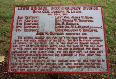
Lewis' Brigade
Breckinridge's Division
— Brig. Gen. Joseph H. Lewis —
Brig. Gen. Joseph H. Lewis.
Nov. 25th 1863.
2nd Kentucky - Lieut. Col. James W. Moss.
4th Kentucky - Maj. Thomas W. Thompson.
5th Kentucky - Col. H. Hawkins.
6th Kentucky - Lieut. Col. W. L. Clarke, (Detached).
9th Kentucky - Lieut. Col. John C. Wickliffe.
John H. Morgan's - dismounted men.
The Brigade reached this position from near Bragg's Headquarters in the early morning of the 25th. The 9th Kentucky occupied an interval in the front line on the right of Smith's Brigade, and left of Govan's, facing north, near the base of the hill east of this point, and actively engaged in checking the Union advance, but with slight loss. The 6th Kentucky had been left to guard Chickamauga Station, and remained at that point till the close of the battle.
The other regiments of the brigade occupied this position in rear of Smith's Texas Brigade, and were changed to support any portion of the line menaced, as emergency required, but were not actively engaged.
Erected 1890 by the Chickamauga-Chattanooga National Battlefield Commission. (Marker Number MT-376.)
Topics and series. This historical marker is listed in this topic list: War, US Civil . In addition, it is included in the Chickamauga and Chattanooga National Military Park, Sherman Reservation, and the Chickamauga and Chattanooga National Military Park: November 25, 1863 series lists. A significant historical date for this entry is October 25, 1863.
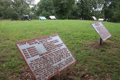
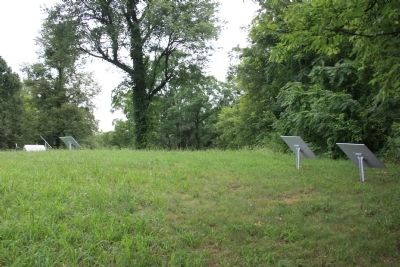
Location. 35° 4.113′ N, 85° 14.424′ W. Marker is in Chattanooga, Tennessee, in Hamilton County. It is in Tree Park. Marker can be reached from North Crest Road north of Lightfoot Mill Road. This historic marker is located in the Sherman Reservation, up on the top of the hill called "Tunnel Hill". Touch for map. Marker is in this post office area: Chattanooga TN 37404, United States of America. Touch for directions.
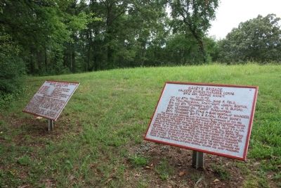
Other nearby markers. At least 8 other markers are within walking distance of this marker. Maney's Brigade (here, next to this marker); Union Casualties (a few steps from this marker); Confederate Casualties (a few steps from this marker); Calvert's Arkansas Battery (a few steps from this marker); Cumming's Brigade (a few steps from this marker); Swett's Mississippi Battery (a few steps from this marker); J. A. Smith's Brigade (within shouting distance of this marker); Matthies' Brigade (about 300 feet away, measured in a direct line). Touch for a list and map of all markers in Chattanooga.
More about this marker. Because of its location in the
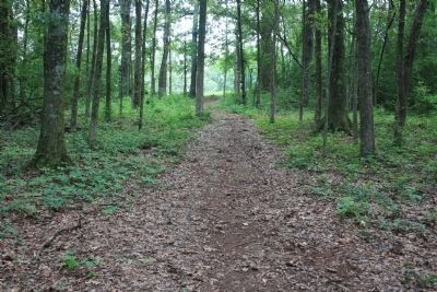
Sherman Reservation it cannot be reached by car and can only be reached by foot. I would suggest parking your car in the provided parking area on Lightfoot Mill Road and then walking north on the Sherman Reservation footpath that begins near the corner of North Crest Road and Lightfoot Mill Road. The path goes up the slope of the hill, through a wooded area, and emerges on a hill top clearing, where the historic marker is located.
Credits. This page was last revised on February 7, 2023. It was originally submitted on August 10, 2012, by Dale K. Benington of Toledo, Ohio. This page has been viewed 500 times since then and 6 times this year. Photos: 1, 2, 3. submitted on August 10, 2012, by Dale K. Benington of Toledo, Ohio. 4, 5. submitted on August 11, 2012, by Dale K. Benington of Toledo, Ohio.
