Near Bartow in Pocahontas County, West Virginia — The American South (Appalachia)
The Great Raid
Path of Destruction
ó Jones-Imboden Raid ó
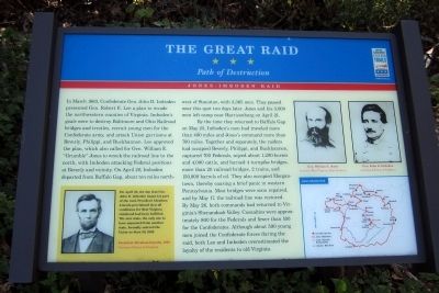
By the time they returned to Buffalo Gap on May 25, Imbodenís men had traveled more than 400 miles and Jonesís command more than 700 miles. Together and separately, the raiders had occupied Beverly, Philippi, and Buckhannon, captured 700 Federals, seized about 1,200 horses and 4,000 cattle, and burned 4 turnpike bridges, more than 20 railroad bridges, 2 trains, and 150,000 barrels of oil. They also occupied Morgantown, thereby causing a brief panic in western Pennsylvania. Most bridges were soon repaired, and by May 17, the railroad line was restored. By May 26, both commands had returned to Virginiaís Shenandoah Valley. Casualties were approximately 800 for the Federals and fewer than 100 for the Confederates. Although about 500 young men joined the Confederate forces during the raid, both Lee and Imboden overestimated the loyalty of the residents to old Virginia.
(sidebar)
On April 20, the day that Gem John D. Imboden began his part of the raid, President Abraham Lincoln proclaimed that all conditions for West Virginia statehood had been fulfilled. The new state, the only one to have separated from another state, formally entered the Union on June 20, 1863.
Erected by West Virginia Civil War Trails.
Topics and series. This historical marker is listed in this topic list: War, US Civil. In addition, it is included in the Former U.S. Presidents: #16 Abraham Lincoln, and the West Virginia Civil War Trails series lists. A significant historical month for this entry is March 1863.
Location. 38° 28.532′ N, 79° 41.952′ W. Marker is near Bartow, West Virginia, in Pocahontas County. Marker is at the intersection of U.S. 250 and Old Pike Road (County Route 3), on the left when traveling west on U.S. 250. Touch for map. Marker is in this post office area: Bartow WV 24920, United States of America. Touch for directions.
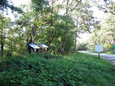
Other nearby markers. At least 8 other markers are within 2 miles of this marker, measured as the crow flies. War In West Virginia (here, next to this marker); The First Campaign (a few steps from this marker); Camp Allegheny (a few steps from this marker); West Virginia / Virginia (a few steps from this marker); Highland County / West Virginia (within shouting distance of this marker in Virginia); a different marker also named Camp Allegheny (approx. 0.7 miles away in Virginia); Camp Allegheny 1861-1862 (approx. 1.3 miles away); a different marker also named Camp Allegheny (approx. 1.3 miles away). Touch for a list and map of all markers in Bartow.
More about this marker. On the upper right are portraits of Gen. William E. Jones Courtesy West Virginia State Archives and Gen. John D. Imboden Courtesy Library of Congress
On the lower left is a portrait of President Abraham Lincoln, 1863 Courtesy Library of Congress
On the lower right is a map of the Jones-Imboden Raid
Credits. This page was last revised on June 16, 2016. It was originally submitted on August 11, 2012, by Bernard Fisher of Richmond, Virginia. This page has been viewed 829 times since then and 29 times this year. Photos: 1, 2. submitted on August 11, 2012, by Bernard Fisher of Richmond, Virginia.

