Sutton in Braxton County, West Virginia — The American South (Appalachia)
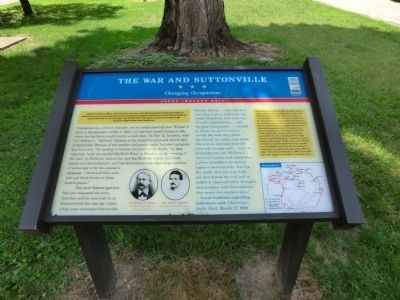
The War and Suttonville
Changing Occupations
— Jones-Imboden Raid —
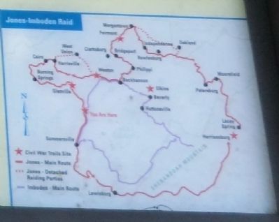
Confederate Gen. John D. Imboden and his cavalry men left Gen. William E. Jones at Buckhannon on May 6, 1863, and marched toward Summerville, where the two forces would reunite a week later. On May 12, Imboden, with Col. William L. “Mudwall” Jackson and his second-in-command struck here at Suttonville. Because of bad weather and muddy roads, Imboden’s progress had been slow. “No incident of interest occurred on the march,” he later reported, “until we reached Big Birch River, in Braxton, on the evening of the 12th. At Bulltown, Suttonville, and Big Birch the enemy had block-houses and intrenchments, and had destroyed at each place large amounts of stores laid in for the summer’s campaign. I destroyed their quarters and block-houses at these several places.”
The small Federal garrison had just evacuated the town. Imboden and his men rode on to Summersville the next day. Union troops soon reoccupied Suttonville.
"Phoebe Hefner ... came [to Suttonville] to get a doctor for her sister, Elizabeth, who was very ill with typhoid fever, ... but the post commander ... refused to allow the girl to return ... [until] the next day [when she found] her sister was dead. She was so incensed that she planned revenge and ... went to [Confederate Col. William L.] Jackson's camp and asked that a force of soldiers be sent to capture Sutton[ville]. During the night that she was held ... she had heard the roll call of soldiers, observed their strength and position and this information made the capture easy."
- Local tradition regarding Imboden's raid, Charleston Daily Mail, March 27, 1938
(Sidebar): The Weston and Gauley Bridge Turnpike was one of the better roads in a section of the state with difficult terrain and few roads of any kind. It was macadamized (hard-surfaced) in parts, and farmers used it to transport grain and timber to the gristmills and sawmills in Suttonville. During the war, both Union and Confederate forces considered the turnpike to be of strategic importance for moving men and supplies north and south. Suttonville's location on the turnpike guaranteed that the contending forces would occupy or march through the community several times. In the summer of 1861, Union Gen. William S. Rosecrans and his 10,000-man army camped here, the largest force that ever bivouacked in Suttonville or marched through central West Virginia. They left on September 7, 1861. Three days later the fought the Battle of Carnifex Ferry.
Erected by West Virginia Civil War Trails.
Topics and series. This historical marker is listed in this topic list: War, US Civil. In addition, it is included in the West Virginia Civil War Trails series list. A significant historical month for this entry is April 1863.
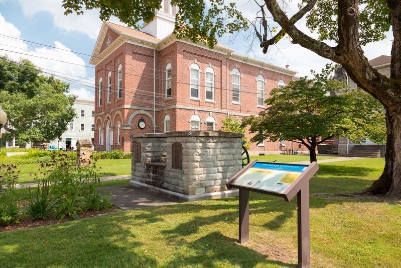
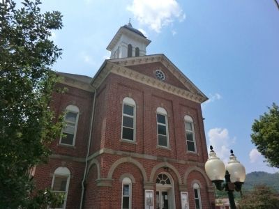
Location. 38° 39.87′ N, 80° 42.522′ W. Marker is in Sutton, West Virginia, in Braxton County. Marker is at the intersection of Main Street and 3rd Street, on the right when traveling west on Main Street. On the grounds of the Braxton County Courthouse. Touch for map. Marker is at or near this postal address: 300 Main Street, Sutton WV 26601, United States of America. Touch for directions.
Other nearby markers. At least 8 other markers are within 9 miles of this marker, measured as the crow flies. How Did Braxton County Get Its Name? (a few steps from this marker); World War 1917–18 Memorial (within shouting distance of this marker); Revolutionary War Monument (within shouting distance of this marker); Burning of Sutton (approx. 0.4 miles away); Fighting and Flames (approx. 0.4 miles away); Geographic Center (approx. 3 miles away); Skirmish at Salt Lick Bridge (approx. 8.8 miles away); Nicholas County / Braxton County (approx. 8.8 miles away). Touch for a list and map of all markers in Sutton.
Credits. This page was last revised on August 16, 2021. It was originally submitted on August 24, 2012, by Don Morfe of Baltimore, Maryland. This page has been viewed 1,051 times since then and 47 times this year. Photos: 1. submitted on August 24, 2012, by Don Morfe of Baltimore, Maryland. 2. submitted on August 16, 2021, by J. J. Prats of Powell, Ohio. 3, 4. submitted on August 24, 2012, by Don Morfe of Baltimore, Maryland. 5. submitted on September 10, 2012, by Don Morfe of Baltimore, Maryland. • Craig Swain was the editor who published this page.
