Four Oaks in Johnston County, North Carolina — The American South (South Atlantic)
Village of Bentonville
Inscription.
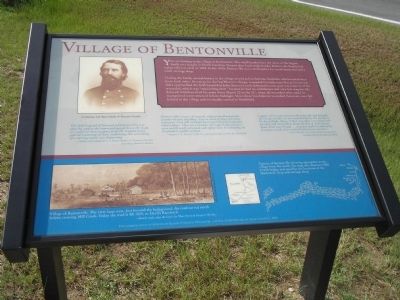
You are looking at the village of Bentonville. This small hamlet bore the name of the largest battle ever fought in North Carolina. Named after local resident John Benton, the hamlet had a post office as early as 1849. In the 1860s Bentonville was a marketplace for naval stores and had a small carriage shop.
During the battle, several homes in the village served as Confederate hospitals, which treated men from both sides. At one point during Mower’s charge, wounded Confederates fled as Union soldiers approached the field hospital in John Benton’s yard. Johnston’s main goal was removal of the wounded, which was “maddening slow” because he had no ambulances and very few wagons. He delayed withdrawal of his army from March 20 to the 21st, when all wounded who could be transported were removed before midnight. Sixty-three Confederate wounded, however, were left behind in the village and eventually carried to Smithfield.
“The field hospital of General Johnston’s army was close by, and as the command passed down the road, we could see men escaping from the hospital and a general scattering of men, evidencing that something of a stirring nature was happening….”
Soldier of Col. Baxter Smith’s 4th Tennessee Cavalry describing Mower’s advance.
“[Bentonville] consists of scarcely a dozen small unpainted weather-beaten dwellings. Two or three of these primitive tenements were still occupied by several severely wounded rebel soldiers. They were destitute of hospital conveniences, were indifferently attended and appeared to be subsisting on the plainest quality of food.”
Surgeon J.A. Mowris, 117th N.Y., passing through 3 weeks after the battle.
“Logan’s [XV] corps went into Bentonville and brought off a large number of our wounded left by the enemy in his hasty flight. Many of their wounded were found and paroled, and everywhere along the line of their retreat dead rebels were found…no point could be selected in that pine woods where rebel dead were not in view.”
E.D. Westfall, New York Herald correspondent traveling with the Federal Left Wing.
Erected 2005 by North Carolina Civil War Trails.
Topics. This historical marker is listed in this topic list: War, US Civil. A significant historical month for this entry is March 1863.
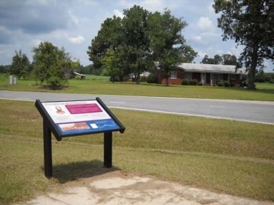
Location. 35° 20.8′ N, 78° 17.638′ W. Marker is in Four Oaks, North Carolina, in Johnston County. Marker is at the intersection of Westbrook Lowgrounds Road (County Route 1198) and Bentonville Road (County Route 1197), on the right when traveling east on Westbrook Lowgrounds Road. Touch for map. Marker is at or near this postal address: 121 Westbrook Lowgrounds Rd, Four Oaks NC 27524, United States of America. Touch for directions.
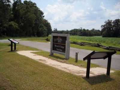
Other nearby markers. At least 8 other markers are within walking distance of this marker. Mower’s Charge Reaches Johnston’s Headquarters (a few steps from this marker); Hardee’s Counterattack (a few steps from this marker); Johnston’s Headquarters (within shouting distance of this marker); Johnston Establishes His Headquarters (about 400 feet away, measured in a direct line); a different marker also named Village of Bentonville (approx. ¼ mile away); Bentonville (approx. ¼ mile away); Confederate Works (approx. half a mile away); Mill Creek (approx. 0.6 miles away). Touch for a list and map of all markers in Four Oaks.
More about this marker. The top section of the marker features a photo of “Confederate Col. Baxter Smith, 4th Tennessee Cavalry.”
The bottom section of the marker features a picture of the “Village of Bentonville. The view faces west. Just beyond the background, the road curved north before crossing Mill Creek. Today the road is SR 1009, or Devil’s Racetrack.” - Sketch made after the battle by Theo Davis of Harper’s Weekly.
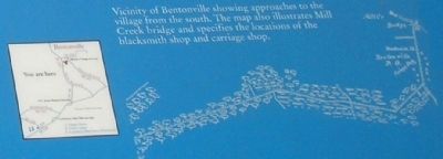
Also present is a map showing the “Vicinity of Bentonville showing approaches to the village from the south. The map also illustrates Mill Creek bridge and specifies the location of the blacksmith shop and carriage shop.”
Related markers. Click here for a list of markers that are related to this marker. Take
a tour of the Roadside Exhibits erected on the Battle of Bentonville for the 140th anniversary of the battle, on March 14, 2005.
Credits. This page was last revised on May 10, 2023. It was originally submitted on March 1, 2008, by Bill Coughlin of Woodland Park, New Jersey. This page has been viewed 1,407 times since then and 27 times this year. Last updated on May 9, 2023, by Michael Buckner of Durham, North Carolina. Photos: 1. submitted on March 1, 2008, by Bill Coughlin of Woodland Park, New Jersey. 2, 3. submitted on August 12, 2010, by Bill Coughlin of Woodland Park, New Jersey. 4, 5. submitted on March 1, 2008, by Bill Coughlin of Woodland Park, New Jersey. • J. Makali Bruton was the editor who published this page.
