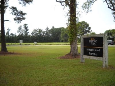
Four Oaks in Johnston County, North Carolina — The American South (South Atlantic)
Fighting South of the Goldsboro Road: The “Bull Pen”
Inscription.
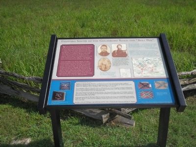
You are looking south of the Goldsboro Road at the area where Union Brig. Gen. James D. Morgan’s division began a defensive position facing Gen. Robert F. Hoke’s division after being deflected by the main Confederate line. These battle-hardened Union veterans had difficulty fortifying their position in the swampy, dense mass of trees and briars. Because of this harsh terrain, Morgan’s division was without artillery support. One participant in the fighting referred to this hotly contested area as the “Bull Pen.” The fighting here was so intense the surrounding woods caught fire.
Union skirmishers from Miles’s brigade of Carlin’s division deployed in front of Morgan’s line and were thrown back by Hoke’s Division during its initial assault. The Federal high command decided to use Morgan’s division as a stopgap until the arrival of reinforcements from the XX Corps. Attacked on three sides by Hoke’s soldiers and elements of the Army of Tennessee, Morgan’s men held out in heavy hand-to-hand combat until Cogswell’s brigade of the XX Corps relieved pressure from the rear of their position.
“We saw nothing in four years of army life to compare with that 19th of March at Bentonville.”
- Lt. R.J. Heath, 34th Illinois.
“The men in Union Brig. Gen. John Mitchell’s brigade piled up ‘logs, stumps, limbs…and anything [else] that could be breast-work of timber’ with shovelfuls of muddy soil.”
-Members of Mitchell’s brigade south of Goldsboro Road.
“I started at a lively clip, but had not gone far before I looked back and the Federals had risen up from behind that “bull pen” as thick as black birds on a horse-lot fence…The bullets were whistling, all around me so thick that only the protecting hand of the good Lord enabled me to escape.”
- Pvt. Claude I. Hadaway, 54th Alabama.
(lower sidebar):Fight for the Flags
Fighting in and around the “Bull Pen” on March 19 was the most intense hand-to-hand combat at Bentonville. Soldiers fought to protect the regimental colors of the 54th Virginia, 40th North Carolina, 60th Illinois, 26th Tennessee, and 14th Michigan. Three of the flags were captured.
Two companies of the 60th Illinois became cut off from the rest of their brigade as members of Kirkland’s North Carolina brigade attacked the color bearer with fixed bayonets. A 60th Illinois soldier with his own bayonet stepped forward to save his regimental colors.
Then action turned toward the 40th North Carolina. Cpl. George W. Clute of the 14th Michigan rushed for the Confederate flag, then dragged the color bearer and flag for one hundred feet before the Confederate lieutenant released the staff and fled.
At the same time, the 14th Michigan’s flag was endangered when the entire color guard fell in a devastating volley. Pvt. Henry E. Plant saved his regiment’s banner. Both Clute and Plant received the Medal of Honor thirty years later.
Members of the 14th Michigan captured troops and the colors of both the 26th Tennessee and the 54th Virginia.
Erected 2005 by North Carolina Civil War Trails.
Topics. This historical marker is listed in this topic list: War, US Civil. A significant historical date for this entry is March 19, 1865.
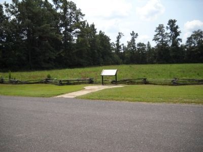
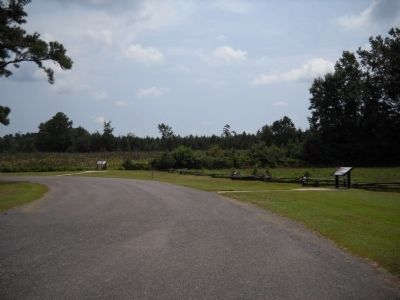
Location. 35° 18.878′ N, 78° 17.998′ W. Marker is in Four Oaks, North Carolina, in Johnston County. Marker is on Harper House Road (County Route 1008), on the right. Touch for map. Marker is at or near this postal address: 4228 Harper House Rd, Four Oaks NC 27524, United States of America. Touch for directions.
Other nearby markers. At least 8 other markers are within walking distance of this marker. First Union Attack (within shouting distance of this marker); Fighting at the Cole Plantation: The “Battle of Acorn Run” (within shouting distance of this marker); Confederate Line Crossing the Goldsboro Road (within shouting distance of this marker); Cole Farmhouse (within shouting distance of this marker); Fighting Below the Road (about 400 feet away, measured in a direct line); Main Confederate Line (approx. 0.2 miles away); Bentonville
(approx. 0.2 miles away); Confederate North Carolina Junior Reserve Line (approx. 0.2 miles away). Touch for a list and map of all markers in Four Oaks.
More about this marker. The top section of the marker features the “Bull Pen” battle map, photos of “Sgt. Evelyn E. Hustead, 55th Ohio, Cogswell brigade, wounded at Bentonville on March 19, dies on April 10 in Goldsboro, 2nd Lt. Frank M. Hayley, 25th Arkansas, Reynold’s brigade, wounded at Bentonville on March 19th, and Capt. Jonas Cook, 8th North Carolina, Clingman’s Brigade. Each of these men witnessed the intense hand-to-hand combat in the ‘Bull Pen’ on March 19.
On the bottom section of the marker are images of the “Flags of the 14th Michigan (from Michigan Capital Collection) and 60th Illinois (from Illinois State Military Museum, Department of Military Affairs)” on the left, and “Flags of the 54th Virginia (from Museum of the Confederacy), 40th North Carolina (from N.C. Museum of History) and 26th Tennessee (from Tennessee Historical Society)”.
Related markers. Click here for a list of markers that are related to this marker. Take a tour of the Roadside Exhibits erected on the Battle of Bentonville for the 140th anniversary of the battle,
on March 14, 2005.
Credits. This page was last revised on May 10, 2023. It was originally submitted on March 2, 2008, by Bill Coughlin of Woodland Park, New Jersey. This page has been viewed 2,466 times since then and 79 times this year. Last updated on May 9, 2023, by Michael Buckner of Durham, North Carolina. Photos: 1. submitted on March 2, 2008, by Bill Coughlin of Woodland Park, New Jersey. 2, 3. submitted on September 5, 2010, by Bill Coughlin of Woodland Park, New Jersey. 4. submitted on March 2, 2008, by Bill Coughlin of Woodland Park, New Jersey. 5. submitted on September 5, 2010, by Bill Coughlin of Woodland Park, New Jersey. • J. Makali Bruton was the editor who published this page.
