Four Oaks in Johnston County, North Carolina — The American South (South Atlantic)
Confederate Line Crossing the Goldsboro Road
Inscription.
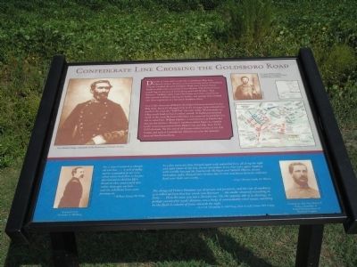
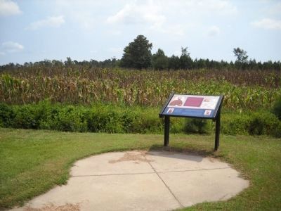
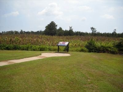
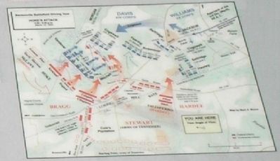
Directly in front and to your left, Confederate Maj. Gen. Robert F. Hoke’s division, on loan from the Army of Northern Virginia, blocked the old Goldsboro Road (now Harper House Road) to deflect the oncoming Union advance. The division was a mixed bag of veterans of Gettysburg and Cold Harbor, “Red Infantry” (artillery units from Fort Fisher and other coastal forts who served as infantry during the battle), and teenage boys formed into three regiments as a last-ditch Southern effort.
Late in the afternoon of March 19, Hoke’s Division attacked Union Brig. Gen. James D. Morgan’s line in the swampy, brier-infested area south of the road, the “Bull Pen” (to your right). With limited visibility, much hand-to-hand combat ensued. As fighting intensified north of the road, McLaws’s Division was removed from Hoke’s far left to assist Gen. William Hardee – a tactical error, as Hardee did not use the division. Morgan’s northern salient began to crumble under mounting pressure from Hoke’s line and Maj. Gen. D.H. Hill’s division. Yet the arrival of Union reinforcements of the XX Corps, and lack of Confederate initiative to seize the moment, doomed Southern efforts.
“For a time it seemed as though all was lost….A yell of indignation resounded in our ears when every man flew to his pos. determined to shed his life’s blood on that consecrated spot rather than give an inch…and the rebellious hosts came pressing on.”
- William Kemp, 98th Ohio.
“In a few moments they charged again with redoubled fury, all along the right and right center of the line. In our immediate front they were again repulsed, with terrible loss and the Fourteenth Michigan and Sixtieth Illinois, on our immediate right, charged their broken line in turn and drove them in confusion back over their own works….”
- Capt. Herman Lund, 16th Illinois.
“The charge [of Hoke’s Division] was desperate and persistent, and the roar of musketry, as it rolled up from that low wood, was incessant…the smoke obscured everything in front….Here the view was not a cheerful one. On the opposite side of [a clearing], at perhaps twenty-five yards’ distance, was a body of unmistakably rebel troops, marching by the flank in column of fours, towards the right.”
- Lt. Col. Alexander C. McClurg, chief of staff, Union VIV Corps.
Erected 2005 by North Carolina Civil War Trails.
Topics. This historical marker is listed in this topic list: War, US Civil. A significant historical date for this entry is March 19, 1865.
Location. 35° 18.886′ N, 78° 17.975′ W. Marker is in Four Oaks, North Carolina, in Johnston County. Marker is on Harper House Road (County Route 1008), on the right when traveling east. Touch for map. Marker is at or near this postal address: 4186 Harper House Rd, Four Oaks NC 27524, United States of America. Touch for directions.
Other nearby markers. At least 8 other markers are within walking distance of this marker. First Union Attack (within shouting distance of this marker); Fighting South of the Goldsboro Road: The “Bull Pen” (within shouting distance of this marker); Fighting at the Cole Plantation: The “Battle of Acorn Run” (within shouting distance of this marker); Cole Farmhouse (within shouting distance of this marker); Fighting Below the Road (about 600 feet away, measured in a direct line); Main Confederate Line (about 700 feet away); Bentonville (approx. 0.2 miles away); Confederate North Carolina Junior Reserve Line (approx. 0.2 miles away). Touch for a list and map of all markers in Four Oaks.
More about this marker. The top of the marker features a photo of Gen. Braxton Bragg, commander of the Department of North Carolina (from Valentine Museum) on the left, and a photo of Pvt. James Dallas Croom, Company B, 1st Battalion, North Carolina Heavy Artillery (from James McCallan), and a battle map of Hoke’s Attack on the right.
On the bottom section of the marker has a photo of Union Lt. Col. Alexander C. McClurg (from U.S. Army Military History Institute) on the left, a photo of Confederate Maj. Gen. Robert
F. Hoke, commander of Hoke’s Division, Army of Northern Virginia (from U.S. Army Military History Institute).
Related markers. Click here for a list of markers that are related to this marker. Take a tour of the Roadside Exhibits erected on the Battle of Bentonville for the 140th anniversary of the battle, on March 14, 2005.
Credits. This page was last revised on May 10, 2023. It was originally submitted on March 2, 2008, by Bill Coughlin of Woodland Park, New Jersey. This page has been viewed 1,812 times since then and 20 times this year. Last updated on May 9, 2023, by Michael Buckner of Durham, North Carolina. Photos: 1. submitted on March 2, 2008, by Bill Coughlin of Woodland Park, New Jersey. 2, 3. submitted on August 12, 2010, by Bill Coughlin of Woodland Park, New Jersey. 4, 5. submitted on March 2, 2008, by Bill Coughlin of Woodland Park, New Jersey. • J. Makali Bruton was the editor who published this page.
