Independence in Jackson County, Missouri — The American Midwest (Upper Plains)
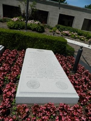
Harry S. Truman Grave
Born May 8, 1884
Lamar, Missouri
Died December 26, 1972
Married June 28, 1919
Daughter
Born February 17, 1924
Judge
Eastern District
Jackson County
Jan. 1, 1923 - Jan 1, 1925
Presiding Judge
Jackson County
Jan. 1, 1927 - Jan. 1, 1935
United States Senator
Missouri
Jan. 3, 1935 - Jan. 18, 1945
Vice President
United States
Jan. 20, 1945 - Apr. 12, 1945
President
United States
Apr. 12, 1945 - Jan. 20, 1953
Topics and series. This historical marker is listed in this topic list: Cemeteries & Burial Sites. In addition, it is included in the Former U.S. Presidents: #33 Harry S. Truman series list. A significant historical month for this entry is February 1807.
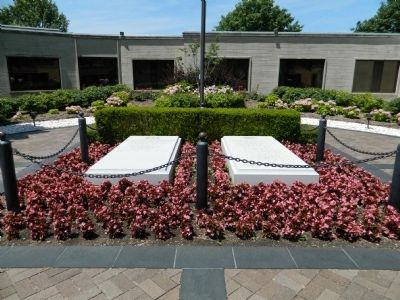
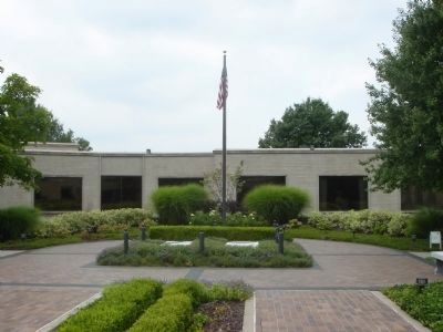
Location. 39° 6.211′ N, 94° 25.283′ W. Marker is in Independence, Missouri, in Jackson County. Marker can be reached from U.S. 24. Grave is in the courtyard of the Truman Library. Touch for map. Marker is at or near this postal address: 500 West Highway 24, Independence MO 64050, United States of America. Touch for directions.
Other nearby markers. At least 8 other markers are within walking distance of this marker. The Eternal Flame of Freedom (a few steps from this marker); Truman Library Veterans Memorial Carillon (within shouting distance of this marker); The Harry S. Truman Library (within shouting distance of this marker); Liberty Bell Replica Marker (about 400 feet away, measured in a direct line); Harry S. Truman Historic District (approx. 0.2 miles away); A Man of Means (approx. 0.4 miles away); Three Trails From Independence (approx. 0.4 miles away); Trails to the East & West (approx. 0.4 miles away). Touch for a list and map of all markers in Independence.
Also see . . . Harry S. Truman Biography - Truman Library & Museum. (Submitted on August 27, 2012, by Bill Pfingsten of Bel Air, Maryland.)

Photographed By Allen C. Browne, August 9, 2015
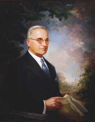
4. Harry S. Truman
This portrait of Harry Truman by Greta Kempton hangs in the National Portrait Gallery in Washington, DC.
“When Franklin Roosevelt died in 1945, his successor, Vice President Harry Truman, felt as if the weight of the world had fallen on him. feeling woefully unprepared, he now had the responsibility for guiding the country through the final phases of World War II and the often-jolting adjustments to peace.
Elected to the presidency in his own right in 1948, Truman had his greatest impact in foreign policy. His most notable achievements included defeating communist takeovers in Greece and Turkey and repelling the USSR's attempt to push the West out of 8erlin. Truman also presided over implementation of the Marshall plan to rebuild Western Europe's war-torn economies, a strategy that may be the greatest triumph in the annals of American diplomacy.
The Vienna-born Greta Kempton was Harry Truman's favorite portraitist. Shortly after she finished what would become his official White House likeness in 1947, she began this portrait. The picture was finally completed in 1970, when former members of Truman's administration presented it to the National Portrait Ga1lery.” — National Portrait Gallery
Credits. This page was last revised on November 23, 2019. It was originally submitted on August 27, 2012, by Bill Pfingsten of Bel Air, Maryland. This page has been viewed 933 times since then and 30 times this year. Photos: 1, 2. submitted on August 27, 2012, by Bill Pfingsten of Bel Air, Maryland. 3. submitted on April 23, 2015, by Pat Filippone of Stockton, California. 4. submitted on September 26, 2015, by Allen C. Browne of Silver Spring, Maryland.


