Lookout Mountain in Hamilton County, Tennessee — The American South (East South Central)
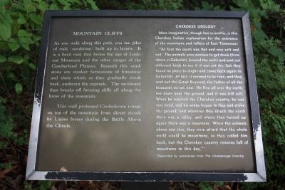
Mountain Cliffs - Cherokee Geology
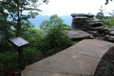
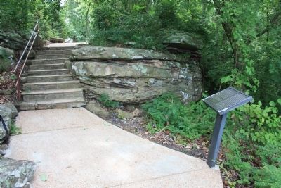
As you walk along this path, you see piles of rock (sandstone) built up in layers. It is a hard rock that forms the cap of Lookout Mountain and the other ranges of the Cumberland Plateau. Beneath this sandstone are weaker formations of limestone and shale which, as they gradually erode back, undercut the caprock. The sandstone then breaks off forming cliffs all along the brow of the mountain.
This wall protected Confederate troops on top of the mountain from direct attack by Union forces during the Battle Above the Clouds.
[Right-Side of Text]: Cherokee Geology
More imaginative, though less scientific is this Cherokee Indian explanation for the existence of the mountains and valleys of East Tennessee:
"At first the earth was flat and very soft and wet. The animals were anxious to get down (from above in Galunlati, beyond the arch) and sent out different birds to see if it was yet dry, but they found no place to alight and came back again to Galunlati. At last, it seemed to be time, and they sent out the Great Buzzard, the father of all the buzzards we see now. He flew all over the earth, low down near the ground, and it was still soft. When he reached the Cherokee country, he was very tired, and his wings began to flap and strike the ground, and wherever they struck the earth there was a valley, and where they turned up again there was a mountain. When the animals above saw this, they were afraid that the whole world would be mountains, so they called him back, but the Cherokee country remains full of mountains to this day."
*Reprinted by permission from The Chattanooga Country.
Topics. This historical marker is listed in these topic lists: Environment • Native Americans • War, US Civil.
Location. 35° 0.718′ N, 85° 20.654′ W. Marker is in Lookout Mountain, Tennessee, in Hamilton County. Marker can be reached from Point Park Road north of East Brow Road. This historic marker is located in Point Park, atop Lookout Mountain, along the walking trail that leads to the Ochs Museum and observation deck at the point of Lookout Mountain. Touch for map. Marker is in this post office area: Lookout Mountain TN 37350, United States of America. Touch for directions.
Other nearby markers. At least 8 other markers are within walking distance of this marker. Garrity's Alabama Battery (within shouting distance of this marker); Corput's Georgia Battery (within shouting distance of this marker); Lookout Mountain Trails (within shouting distance of this marker); Lookout Valley and Browns Ferry (within shouting distance of this marker);
Tennessee River and Moccasin Bend (about 300 feet away, measured in a direct line); Cobham's Brigade (about 300 feet away); Battle of Missionary Ridge (about 300 feet away); Battle Above the Clouds (about 300 feet away). Touch for a list and map of all markers in Lookout Mountain.
Credits. This page was last revised on June 16, 2016. It was originally submitted on August 27, 2012, by Dale K. Benington of Toledo, Ohio. This page has been viewed 500 times since then and 26 times this year. Photos: 1, 2, 3. submitted on August 28, 2012, by Dale K. Benington of Toledo, Ohio.


