Johnstown in Fulton County, New York — The American Northeast (Mid-Atlantic)
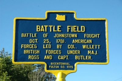
Battle Field
Oct. 25, 1781. American
forces led by Col. Willett
British forces under Maj.
Ross and Capt. Butler.
Bicentennial
Fulton Co. 1975
Erected 1975 by Fulton County.
Topics. This historical marker is listed in this topic list: War, US Revolutionary. A significant historical year for this entry is 1781.
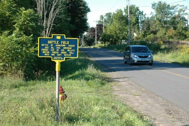
Location. 43° 1.256′ N, 74° 22.896′ W. Marker is in Johnstown, New York, in Fulton County. Marker is on Johnson Ave., on the right when traveling north. Touch for map. Marker is in this post office area: Johnstown NY 12095, United States of America. Touch for directions.
Other nearby markers. At least 8 other markers are within walking distance of this marker. Site of Battle In American Revolution (about 500 feet away, measured in a direct line); Who Was Sir William Johnson ? (approx. 0.4 miles away); Johnson Hall / The Landscape of Johnson Hall (approx. 0.4 miles away); Johnson Hall State Historic Site (approx. 0.4 miles away); Johnson Hall 1762 (approx. 0.4 miles away); Landscaping Johnson Hall (approx. half a mile away); Johnson Hall (approx. 0.6 miles away); In Memory of Sir William Johnson, Baronet. (approx. 0.6 miles away). Touch for a list and map of all markers in Johnstown.
Regarding Battle Field. In 1781 a British raiding party of almost 600 Loyalists and 130 Indians led by Major John Ross and Walter Butler burned the Mohawk Valley to within 12 miles of Schenectady. They then retreated to Johnstown, closely followed by Col. Marinus Willett and about 400 Americans. The militia attacked the British in a battle strung out along today's Johnson Avenue.
Bone-tired from several weeks of campaigning and drenched by heavy rain, the British continued to fight and captured the American's only piece of artillery. Willett's force retreated and regrouped before attacking again. Finally darkness fell and the fighting ended with both sides claiming they had the upper hand. Under cover of darkness, Ross's men slipped away to the north.
This battle on October 25, 1781, occurred six days after British General Cornwallis surrendered to George Washington at Yorktown. Col. Willet continued to follow the retreating raiders and in a skirmish at the West Canada Creek on October 30, Walter Butler was killed. Major Ross and the last of his men escaped through the mountains to Fort Oswego. Thus ended the war in the Mohawk Valley.
Credits. This page was last revised on June 16, 2016. It was originally submitted on August 30, 2012, by Howard C. Ohlhous of Duanesburg, New York. This page has been viewed 588 times since then and 24 times this year. Photos: 1, 2, 3. submitted on August 30, 2012, by Howard C. Ohlhous of Duanesburg, New York. • Bill Pfingsten was the editor who published this page.


