Fort Smith in Sebastian County, Arkansas — The American South (West South Central)
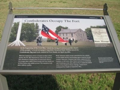
Confederates Occupy The Fort
Fort Smith National Historic Site
— National Park Service, U.S. Department of the Interior —
At the beginnings of the Civil War, “amid the firing of cannon and the cheers of the people,” a local newspaper reported, Arkansas State Militia raised the Confederate flag and took control of Fort Smith on April 23, 1861.
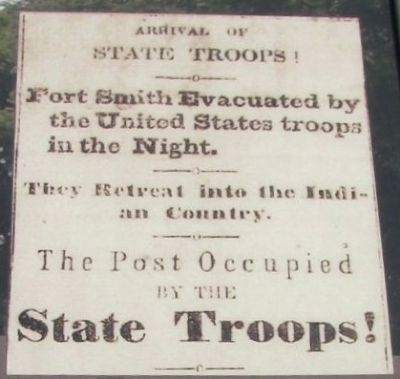
With the Confederate victory in South Carolina at Fort Sumter, the U.S. War Department ordered all southern forts abandoned. Despite pleas of concerned citizens, U.S. troops (later called Union troops) left Fort Smith just an hour before state militia arrived. The transition took place without conflict.
While Arkansas militia troops controlled the fort, citizens of Fort Smith and the surrounding region remained deeply divided. Many pro-Unionist kept silent, suppressed their loyalties, or left town. After Union victories at Gettysburg and Vicksburg in July 1863 followed by Confederate defeat west of Fort Smith at Honey Springs, Union forces reclaimed Fort Smith in September 1863.
Erected by National Park Service, U.S. Department of the Interior.
Topics. This historical marker is listed in this topic list: War, US Civil. A significant historical month for this entry is April 1893.
Location. 35° 23.294′ N, 94° 25.802′ W. Marker is in Fort Smith, Arkansas, in Sebastian County. Marker is on Parker Avenue, on the left when traveling north. Touch for map. Marker is at or near this postal address: 301 Parker Avenue, Fort Smith AR 72901, United States of America. Touch for directions.
Other nearby markers. At least 8 other markers are within walking distance of this marker. Meeting of Nations (within shouting distance of this marker); The Officer’s Quarters (within shouting distance of this marker); Clues from the Past (within shouting distance of this marker); Old Federal Building (within shouting distance of this marker); Defending Freedom (within shouting distance of this marker); Barracks, Courthouse, Jail (within shouting distance of this marker); Executions at Fort Smith (within shouting distance of this marker); The Gallows (within shouting distance of this marker). Touch for a list and map of all markers in Fort Smith.
Credits. This page was last revised on June 12, 2020. It was originally submitted on September 2, 2012, by Denise Boose of Tehachapi, California. This page has been viewed 670 times since then and 25 times this year. Photos: 1, 2, 3, 4. submitted on September 2, 2012, by Denise Boose of Tehachapi, California. • Craig Swain was the editor who published this page.


