Fountain Valley in Orange County, California — The American West (Pacific Coastal)
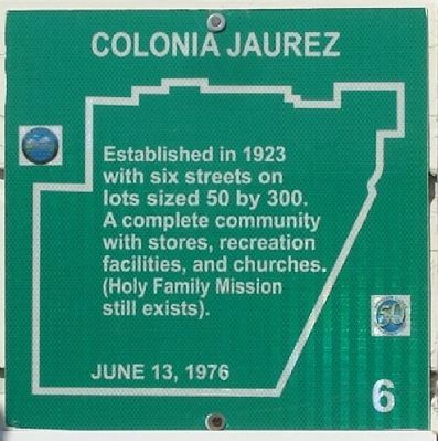
Colonia Jaurez
Erected 1976 by Fountain Valley Historical Society. (Marker Number 6.)
Topics. This historical marker is listed in these topic lists: Churches & Religion • Hispanic Americans • Industry & Commerce • Settlements & Settlers. A significant historical year for this entry is 1923.
Location. 33° 42.891′ N, 117° 56.757′ W. Marker is in Fountain Valley, California, in Orange County. Marker is on Ward Street, on the right when traveling south. Touch for map. Marker is at or near this postal address: 17101 Ward Street, Fountain Valley CA 92708, United States of America. Touch for directions.
Other nearby markers. At least 8 other markers are within one mile of this marker, measured as the crow flies. Hoffman House (approx. 0.4 miles away); Horse Ranch (approx. 0.6 miles away); Thomas Hittesdorf (approx. 0.8 miles away); Helicopter Landing Pad (approx. 0.8 miles away); Rancho Lucero (approx. one mile away); Nimocks Home (approx. one mile away); Ishii Home (approx. one mile away); Fountain Valley Drive-In (approx. one mile away). Touch for a list and map of all markers in Fountain Valley.
More about this marker. Title is misspelled: "Jaurez" should be "Juarez". Source: Fountain Valley Historical Society Presents a Guide to our City's Historical Sites. 1976.
Additional commentary.
1.
In 1923, Mrs. Ashby Turner and Josephine M. Turner subdivided a 40 acre parcel located on the southwest corner of Wintersberg Avenue (now Warner) and Ward Street. They recorded the tract map (569), showing streets, alleys and double sized lots (50 by 300). The Turners with the aid of Mr Salomon Gonzales and his wife Eva named four streets with Mexican names and called this settlement Colonia Juarez in honor of the Mexican hero, Benito Juarez.
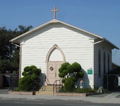
The Colonia was a complete community with stores, recreation facilities and churches. The Holy Family Mission still exists on this site. Transportation in the early days was by horse and buggy, bicycle or the "red car." Residents would walk a mile south to the corner of Talbert Avenue and Ward Street to board the interurban to either Santa Ana or Huntington Beach. The children from the Colonia all attended Fountain Valley School, two miles south and west from their homes.
The City of Fountain Valley recently rezoned the Colonia from A-1 (agriculture) to R-1 (single family residence).
— Submitted February 8, 2015, by Patrick Bui of Irvine, California.
Credits. This page was last revised on June 16, 2016. It was originally submitted on September 3, 2012, by Greg Ullman of Fountain Valley, California. This page has been viewed 1,405 times since then and 70 times this year. Photos: 1, 2. submitted on September 24, 2012, by Greg Ullman of Fountain Valley, California. • Syd Whittle was the editor who published this page.

