Fayetteville in Fayette County, West Virginia — The American South (Appalachia)
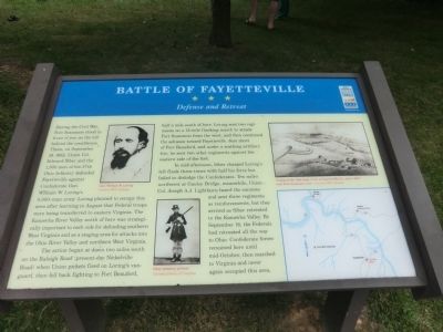
Battle of Fayetteville
Defense and Retreat
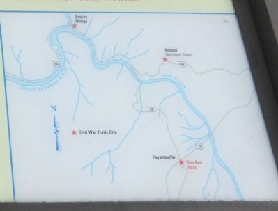
The action began at dawn two miles south on the Raleigh Road (present-day Nickelville Road) when Union pickets fired on Loring’s vanguard, then fell back fighting to Fort Beauford, half a mile south of here. Loring sent two regiments on a 13-mile flanking march to attack Fort Scammon from the west, and then continued the advance toward Fayetteville. Just short of Fort Beauford, and under a scathing artillery fire, he sent two other regiments against the eastern side of the fort.
In mid-afternoon, Siber charged Loring’s left flank three times with half his force but failed to dislodge the Confederates. Ten miles northwest at Gauley Bridge, meanwhile, Union Col. Joseph A.J. Lightburn heard the cannons and sent three regiments as reinforcements, but they arrived as Siber retreated to the Kanawha Valley. By September 16, the Federals had retreated all the way to Ohio. Confederate forces remained here until mid-October, then marched to Virginia and never again occupied this area.
Erected by West Virginia Civil War Trails.
Topics and series. This historical marker is listed in this topic list: War, US Civil. In addition, it is included in the West Virginia Civil War Trails series list. A significant historical month for this entry is September 1853.
Location. 38° 3.192′ N, 81° 6.252′ W. Marker is in Fayetteville, West Virginia, in Fayette County. Marker is at the intersection of North Court Street (State Highway 16) and Wiseman Avenue, on the right when traveling north on North Court Street. This marker is on the Courthouse lawn. Touch for map. Marker is at or near this postal address: 310 North Court Street, Fayetteville WV 25840, United States of America. Touch for directions.
Other nearby markers. At least 8 other markers are within walking distance of this marker. Abraham Vandal (a few steps from this marker); Fayetteville (a few steps from this marker); Marquis de Lafayette (within shouting distance of this marker); Fayette County Law Enforcement Officers' Memorial (within shouting distance of this marker); Morris Harvey House (about 500 feet away, measured in a direct line); American Legion Post 149 Veterans Memorial Torch (about 500 feet away); Fayette County Soldiers & Sailers Memorial Building (about 500 feet away); Land Of The Free (about 600 feet away). Touch for a list and map of all markers in Fayetteville.
Credits. This page was last revised on June 16, 2016. It was originally submitted on September 6, 2012, by Don Morfe of Baltimore, Maryland. This page has been viewed 1,447 times since then and 74 times this year. Photos: 1, 2. submitted on September 6, 2012, by Don Morfe of Baltimore, Maryland. 3. submitted on September 10, 2012, by Don Morfe of Baltimore, Maryland. • Craig Swain was the editor who published this page.


