Green Township near Chillicothe in Ross County, Ohio — The American Midwest (Great Lakes)
Catherine Gougar
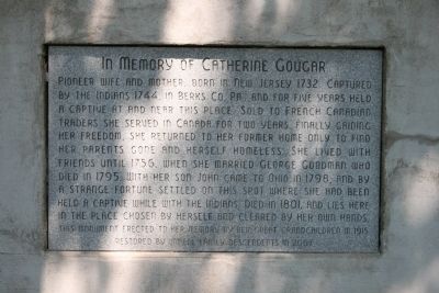
Pioneer wife and mother. Born in New Jersey 1732. Captured by Indians 1744, in Berks Co. PA and for five years held a captive at and near this place. Sold to French Canadian traders she served in Canada for two years. Finally gaining her freedom, she returned to her former home only to find her parents gone and herself homeless. She lived with her friends 1756, when she married George Goodman who died in 1795. With her son John came to Ohio in 1798, and by a strange fortune settled on this spot where she had been held a captive while with the Indians. Died in 1801, and lies here in the place chosen by herself and cleared by her own hands.
Restored by Immell family descendents in 2007
Erected 1915 by the Great Grandchildren of Catherine Gougar.
Topics. This historical marker is listed in these topic lists: Native Americans • Settlements & Settlers • Wars, US Indian. A significant historical year for this entry is 1744.
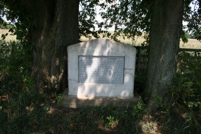
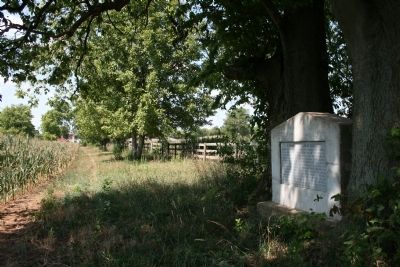
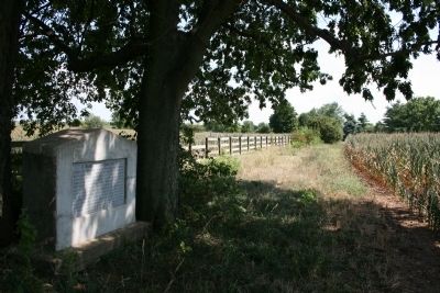
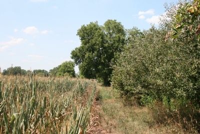
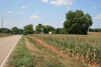
Location. 39° 27.274′ N, 82° 58.644′ W. Marker is near Chillicothe, Ohio, in Ross County. It is in Green Township. Marker can be reached from Orr Road (County Route 526) north of U.S. 23, on the right when traveling north. This historic marker is located north of the farm house at 1440 Orr Road, on the back edge of the farm field, about 40 yards east of the road. The marker is situated in front of a wooden fence, tightly wedged between two trees. When the planted crops have started growing, the view of the marker is blocked from the roadside. Touch for map. Marker is at or near this postal address: 1440 Orr Road, Chillicothe OH 45601, United States of America. Touch for directions.
Other nearby markers. At least 8 other markers are within 4 miles of this marker, measured as the crow flies. Nelson John Dunlap (approx. 2.6 miles away); Monument to Logan (approx. 4 miles away); Cornstalk (approx. 4 miles away); Chief Logan / Logan Elm (approx. 4 miles away); Grenadier Squaw (Non-hel-e-ma) (approx. 4 miles away); John Boggs Memorial (approx. 4 miles away); Site of Logan Elm (approx. 4 miles away); Among Those Present (approx. 4 miles away).
More about this marker. The following information was copied from the Ohio Archaeological and Historical Quarterly, Volume 31, Page 302: "West of the Chillicothe-Columbus Pike a short distance south of the Alfred Immell home, there was erected in 1915 a fine monument to mark the last resting place of Catherine Gougar Goodman, the first white woman in Ross County of which there is any positive record.
This monument is near the road from which a well beaten path indicates that it is frequently visited by the passers-by. It was erected by the descendants of Catherine Gougar, headed by Honorable Oliver P. Goodman, former member of the Ohio House of Representatives and mayor of Kingston, Ohio. Many of the family lived in Green Township and Chillicothe. The spot where the monument stands Catherine Gougar Goodman cleared herself and requested that she should be buried there. It was there that she was held captive by the Shawano Indians in the long ago. This is historic ground and is visited each year by many tourists."
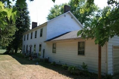
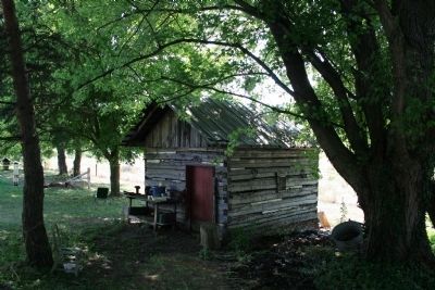
Regarding Catherine Gougar. While I was taking pictures of this historical marker I had an opportunity to talk with the farmer, Mr. Davis, who owned both the farm and farmland where the historical marker is located, as well as the farm across the street. He indicated that he was involved in the building of the farm house, across the street from the historical marker, around the still standing log house of Catherine Gougar. He also indicated that one of that farm's log out-buildings also dated back to the time of Catherine Gougar.
Also see . . .
1. Catherine Gougar. Ohio Archeological and Historical Quarterly; Volume 31, pages 295-303 at Google Books (Submitted on September 15, 2012, by Dale K. Benington of Toledo, Ohio.)
2. Catherine Gouger Goodman. Find A Grave website entry (Submitted on March 5, 2024, by Larry Gertner of New York, New York.)
Additional commentary.
1. Acknowledgement
I would like to acknowledge that John Winkler, the author of "Wabash 1791, St. Clair's defeat," was kind enough to take me on a historic marker tour, and this was one of the historic markers that he shared with me.
— Submitted September 15, 2012, by Dale K. Benington of Toledo, Ohio.
Credits. This page was last revised on March 5, 2024. It was originally submitted on September 12, 2012, by Dale K. Benington of Toledo, Ohio. This page has been viewed 1,401 times since then and 60 times this year. Photos: 1, 2, 3, 4, 5, 6, 7, 8. submitted on September 15, 2012, by Dale K. Benington of Toledo, Ohio.
