Hurricane in Washington County, Utah — The American Mountains (Southwest)
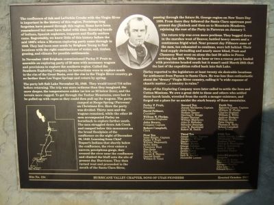
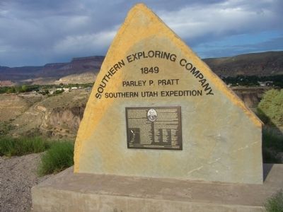
Southern Exploring Company - 1849
Parley P. Pratt
Southern Utah Expedition
In November 1849 Brigham commissioned Parley P. Pratt to assemble an exploring party of 50 men with necessary wagons and provisions to explore the southern region. Called the Southern Exploring Company, its instructions were to explore south to the rim of the Great Basin, over the rim to the Virgin River country, go no farther than Las Vegas Springs and return by spring.
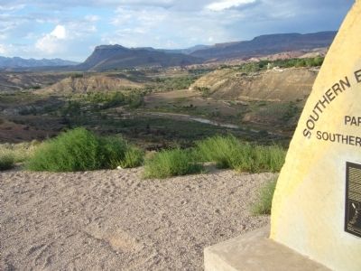
The party left Salt Lake November 23, 1849. They would travel 716 miles before returning. The trip was more arduous than they imagined, the snow deeper, the temperatures colder (as low as 30 below Zero), and the terrain more rugged. To get through the Tushar Mountains, oxen had to be pulled up with ropes so they could then pull the wagons. The party camped at Heaps Spring (Parowan) on Christmas Eve. Here the party was divided. Thirty men and the wagons remained, while the other 20 men accompanied Parley on horseback to explore farther south. The men struggled down Ash Creek and camped below this monument on the broad floodplain of the confluence on the night of December 30, 1849. Learning from Chief Toquer's Indians that shortly below the confluence, the river enters a narrow, precipitous gorge, they crossed the river near the confluence and climbed the bluff onto the site of present day Hurricane. They then turned west and proceeded to the mouth of the Santa Clara River, passing through the future St. George region on New Years Day 1850. From there they followed the Santa Clara upstream past present day Gunlock and then on to Mountain Meadows, rejoining the rest of the Party in Parowan on January 7.
The return trip was even more perilous. They bogged down in the marshes west of Beaver, battled heavy snows and a continuous frigid wind. Near present day Fillmore some of the men, too exhausted to continue, were left behind. Their food supply dwindling and nearly snow blind, Pratt and Chauncey West went on alone the last 50 miles to Provo arriving Jan 28th. Within an hour or two a rescue party loaded with provisions headed south but it wasn't until March 28th that the last of the expedition rolled back into Salt Lake.
Parley reported to the legislature at least twenty six desirable locations for settlement from Payson to Santa Clara. He was less than enthusiastic about the "dreary" Virgin River country, calling it "a wide expanse of chaotic matter a country in ruins."
Many of the Exploring Company were later called to settle the Iron and Cotton Missions. We owe a great debt to these and others who settled these harsh lands, wrestled from the earth a meager existence, and forged out a place for us amidst the stark beauty of these mountains.
Parley P Pratt, President
David Fullmer, Counselor
William W. Phelps, Counselor/Engineer
John Brown, Company Captain
Robert Campbell, Clerk
First Ten Isaac Haight, Captain Parley P Pratt William Wadsworth Rufus Allen Chauncey West Dan Jones Hial K Gay George B. Matson Samuel Could William B. Vance
Second Ten Joseph Matthews, Captain John Brown Nathan Tanner Sterling G. Driggs Homer Duncan William Matthews John D. Holladay Schuyler Jennings John J. Bankhead Robert M. Smith
Third Ten Joseph Horne, Captain Alexander Wright David Fullmer William Brown George Nebeker Benjamin F. Stewart James Farrer Henry Heath Seth B. Tanner Alexander Lemon
Forth Ten Ephraim Green, Captain William W. Phelps Charles Hopkins William Henrie Peter Dustin Thomas E. Ricks Robert Campbell Isaac Brown
Fifth Ten Josiah Arnold, Captain Christopher Williams Stephen Taylor Dimick B. Huntington John C. Armstrong Isaac B. Hatch Jonathan Packer
Joined Company in Sanpete Gardner G Potter Madison D. Hambleton Sylvester Hewlitt John Lowry, Jr. Edward Everett
Erected 2007 by Hurricane Valley Chapter, Sons of Utah Pioneers. (Marker Number 134.)
Topics and series. This historical marker is listed in these topic lists: Exploration • Settlements & Settlers. In addition, it is included in the Sons of Utah Pioneers series list. A significant historical month for this entry is January 1858.
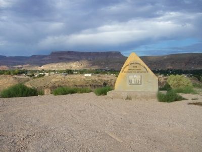
Location. 37° 11.759′ N, 113° 17.331′ W. Marker is in Hurricane, Utah, in Washington County. Marker is on North Main Street, 1.3 miles north of Utah Route 9, on the right when traveling north. Marker is at far north end of Main Street by the Virgin River. Touch for map. Marker is in this post office area: Hurricane UT 84737, United States of America. Touch for directions.
Other nearby markers. At least 8 other markers are within 2 miles of this marker, measured as the crow flies. Look-out Point (approx. half a mile away); Southern Exploring Company 1849 (approx. half a mile away); Hurricane Canal (approx. Ύ mile away); Hurricane/LaVerkin Bridge
(approx. one mile away); The Historic Dixie-Long Valley, Utah Pioneer Trail (approx. 1.1 miles away); The Historic Hurricane Canal (approx. 1.1 miles away); La Verkin (approx. 1.1 miles away); Convict Camp and Wagon Road (approx. 1.2 miles away). Touch for a list and map of all markers in Hurricane.
Credits. This page was last revised on June 16, 2016. It was originally submitted on September 13, 2012, by Bill Kirchner of Tucson, Arizona. This page has been viewed 550 times since then and 13 times this year. Photos: 1, 2, 3, 4. submitted on September 13, 2012, by Bill Kirchner of Tucson, Arizona. • Bill Pfingsten was the editor who published this page.


