Cedar City in Iron County, Utah — The American Mountains (Southwest)
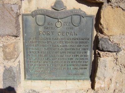
Fort Cedar
Erected 1956 by Camps, Iron Mission & Aunt Margaret - Daughters of Utah Pioneers. (Marker Number 222.)
Topics and series. This historical marker is listed in this topic list: Forts and Castles. In addition, it is included in the Daughters of Utah Pioneers series list. A significant historical month for this entry is November 1851.
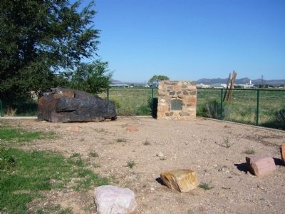
Location. 37° 41.298′ N, 113° 4.787′ W. Marker is in Cedar City, Utah, in Iron County. Marker can be reached from West Industrial Road. Marker is about 100 yards north of Industrial Road, along a dirt path, on the west side of I-15. Touch for map. Marker is in this post office area: Cedar City UT 84721, United States of America. Touch for directions.
Other nearby markers. At least 8 other markers are within walking distance of this marker. The Founding of Southern Utah University (approx. 0.9 miles away); Cedar City Historic Pioneer Cemetery Wall (approx. 0.9 miles away); Pioneer Cabin (approx. one mile away); Legacies of Iron County (approx. one mile away); The Ore Shovel (approx. one mile away); The Hay Derrick (approx. one mile away); Cedar City's Iron Heritage (approx. one mile away); The Caboose (approx. one mile away). Touch for a list and map of all markers in Cedar City.
Credits. This page was last revised on June 16, 2016. It was originally submitted on September 15, 2012, by Bill Kirchner of Tucson, Arizona. This page has been viewed 874 times since then and 47 times this year. Photos: 1, 2. submitted on September 15, 2012, by Bill Kirchner of Tucson, Arizona. • Bill Pfingsten was the editor who published this page.

