Fourth Ward in Houston in Harris County, Texas — The American South (West South Central)
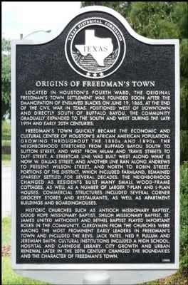
Origins of Freedman's Town
Freedman's Town quickly became the economic and cultural center of Houston's African American population, growing throughout the 1880s and 1890s. The neighborhood stretched from Buffalo Bayou south to Sutton Street, and west from Milam and Travis streets to Taft Street. A streetcar line was built west along what is now W. Dallas Street, and another line ran along Andrews to present Wilson Street, and north to Robin Street. Portions of the district, which included farmland, remained sparsely settled for several decades. The neighborhood changed as residents built many small wood-frame cottages, as well as a number of larger T-plan and L-plan houses. Commercial structures included several corner grocery stores and restaurants, as well as apartment buildings and boardinghouses.
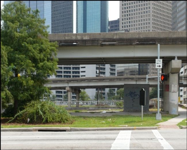
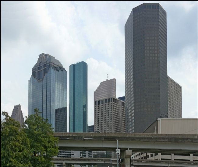
Historic churches such as Antioch Missionary Baptist, Good Hope Missionary Baptist, Shiloh Missionary Baptist, St. James United Methodist and Bethel Baptist played important roles in the community. Clergymen from the churches were among the most prominent early leaders in Freedman's Town and included the Revs. Jack Yates, Ned P. Pullum and Jeremiah Smith. Cultural institutions included a high school, hospital and Carnegie Library. City growth and urban renewal later in the 20th century changed the boundaries and the character of Freedman's Town.
Erected 2005 by Texas Historical Commission. (Marker Number 13317.)
Topics. This historical marker is listed in these topic lists: African Americans • Settlements & Settlers. A significant historical month for this entry is June 1874.
Location. 29° 45.473′ N, 95° 22.51′ W. Marker is in Houston, Texas, in Harris County. It is in the Fourth Ward. Marker is at the intersection of West Dallas Street and Heiner Street, on the right when traveling west on West Dallas Street. Touch for map. Marker is in this post office area: Houston TX 77002, United States of America. Touch for directions.
Other nearby markers. At least 8 other markers are within walking distance of this marker. Bethel Baptist Church (approx. 0.2 miles away); West End Park (approx. 0.2 miles away); Kellum-Noble House (approx. 0.2 miles away); Antioch Missionary Baptist Church (approx. 0.2 miles away); Nichols-Rice-Cherry House (approx. 0.2 miles away); Old San Felipe Road (approx. ¼ mile away); Amos B. Edson (approx. ¼ mile away); Jacob Maybee (approx. ¼ mile away). Touch for a list and map of all markers in Houston.
Related markers. Click here for a list of markers that are related to this marker. To better understand the relationship, study each marker in the order shown.
Also see . . .
1. Houston''s Fourth Ward (Fredman''s Town). The Handbook of Texas Online, Texas State Historical Association (Submitted on September 17, 2012, by Jim Evans of Houston, Texas.)
2. Houston''s Fourth Ward (Freedman''s Town). Wikipedia (Submitted on September 17, 2012, by Jim Evans of Houston, Texas.)
Credits. This page was last revised on February 1, 2023. It was originally submitted on September 17, 2012, by Jim Evans of Houston, Texas. This page has been viewed 1,050 times since then and 41 times this year. Photos: 1, 2, 3. submitted on September 17, 2012, by Jim Evans of Houston, Texas. • Bernard Fisher was the editor who published this page.


