Near Hurricane in Washington County, Utah — The American Mountains (Southwest)
Harrisburg/ Harrisburg Residents
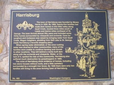
The town of Harrisburg was founded by Moses Harris in 1859. By 1868, twenty-five families had made their homes in this little valley along Quail Creek, located three miles south of Leeds and twelve miles northeast of St. George. The town thrived almost fifty years and included some thirty homes surrounded by vineyards and orchards. Cane for sorghum and molasses was raised by bringing water from Quail Creek. Wagon freighters, plodding from Salt Lake to St. George, made Harrisburg a favorite stopping place.
When spring water diminished, or the once rushing water was diverted to other communities, many of the families were unable to continue farming and moved to other locations. They left behind a newly built dam along with the orchards and vineyards. Water, or the lack of it, spelled the fate of this community. Harrisburg has also suffered much destruction by grasshoppers in 1869.
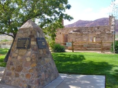
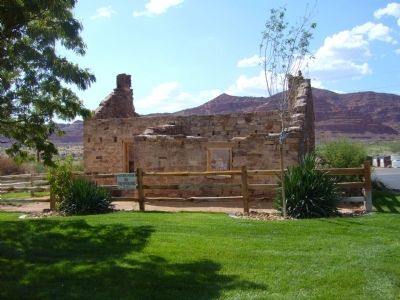
The ruins of Harrisburg show evidence of homes, including two stone houses without roofs, and a little cemetery surrounded by a wrought iron fence. By 1928 there were only two families still living in the once thriving town of Harrisburg.
Harrisburg Residents
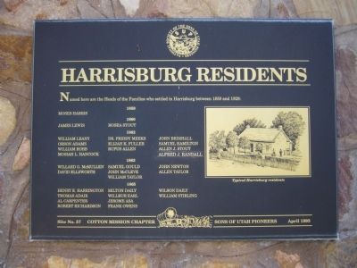
Named here are the heads of families who settled in Harrisburg between 1859 and 1928:
1859 Moses Harris
1860 James Lewis - Hosea Stout
1862 William Leany - Dr. Priddy Meeks - John Brimhall - Orson Adams - Elijah K. Fuller - Samuel Hamilton - William Robb - Rufus Allen - Allen J. Stout - Mosiah L. Hancock - Alfred J Randall
1863 Willard G. McMullen - Samuel Gould - John Newton - David Ellsworth - John McCleve - Allen Taylor - William Taylor
1865 Henry E. Harrington - Milton Daily - Wilson Daily - Thomas Adair - Wilbur Earl - William Stirling - Al Carpenter - Jerome Asa - Robert Richardson - Frank Owens
Site No. 57, Cotton Mission Chapter, Sons of Utah Pioneers April 1993
Erected 1993 by Daughters of Utah Pioneers. (Marker Number 465.)
Topics and series. This historical marker is listed in this topic list: Settlements & Settlers. In addition, it is included in the Daughters of Utah Pioneers series list. A significant historical year for this entry is 1859.
Location. 37° 12.446′ N, 113° 23.57′ W. Marker is near Hurricane, Utah, in Washington County. Marker is on Redbluff Drive, 0.1 miles east of Old Hwy 91, on the right when traveling east. Touch for map. Marker is in this post office area: Hurricane UT 84737, United States of America. Touch for directions.
Other nearby markers. At least 8 other markers are within 3 miles of this marker, measured as the crow flies. Harrisburg (about 500 feet away, measured in a direct line); Harrisburg Historic Pioneer Cemetery (about 600 feet away); "They Were Poor, Hungry, and They Built to Last" (approx. 2.3 miles away); Civilian Conservation Corps, Leeds, Utah (approx. 2.3 miles away); Leeds CCC Camp (approx. 2.3 miles away); Leeds Historic CCC Camp (approx. 2.3 miles away); The Sarah Ann and William Stirling Home (approx. 2.6 miles away); From Native American Trail to Interstate Exit (approx. 2.6 miles away).
Credits. This page was last revised on June 16, 2016. It was originally submitted on September 20, 2012, by Bill Kirchner of Tucson, Arizona. This page has been viewed 685 times since then and 58 times this year. Photos: 1, 2, 3, 4. submitted on September 20, 2012, by Bill Kirchner of Tucson, Arizona. • Bill Pfingsten was the editor who published this page.


