Columbia in Boone County, Missouri — The American Midwest (Upper Plains)
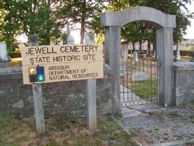
Jewell Cemetery
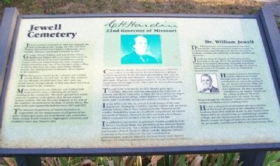
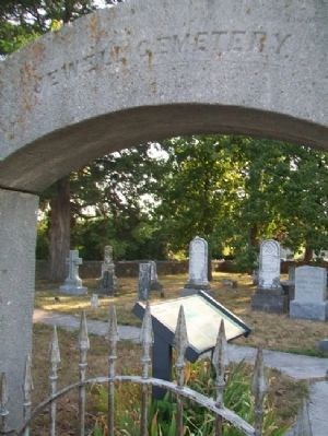
Jewell Cemetery is located on what was originally the farm of George Jewell. George, his wife, and their children first moved from Virginia to Kentucky, then Franklin, Missouri, and finally Columbia in 1822.
George, his son William, and sons-in-law Charles Hardin and William Hitt were all prominent in the community. All served on road commissions and the county court, and helped shape the early community. William Jewell became one of the founders of the college in Liberty that bears his name, and Charles Hardin became the 22nd governor of Missouri. All are buried in the cemetery.
The first person buried in the cemetery was Cynthia Jewell, William's second wife, in 1822. The cemetery was not officially set aside until June 1841, only one month before George's death. At this time, there were four people buried in the cemetery.
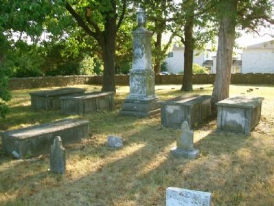
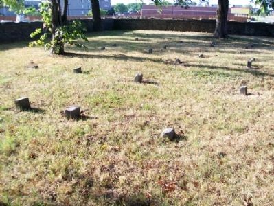
Many of the graves are elaborate and marked with head and foot stones, reflecting the person's standing in the community. The above-ground box tombs mark the locations of the graves; they do not contain human remains. The last two rows of graves at the rear of the cemetery are believed to be those of family slaves. The stone walls were apparently built between 1841 and 1852.
The Missouri Department of Natural Resources is responsible for the maintenance of all graves of the state's former governors not in perpetual care cemeteries. These include Jewell Cemetery, Sappington Cemetery, and Dunklin's Grave state historic sites.
C. H. Hardin
22nd Governor of Missouri
Charles Henry Hardin, Missouri's 22nd governor (1875-77) was widely remembered for his proclamation of prayer invoked against the Rocky Mountain grasshopper that came in "Egyptian multitude into Missouri," destroying all vegetation in their path. Of greater importance, however, was the financial competence he brought to the office and the fiscal achievements of his administration.
Though born in Kentucky in 1820, Hardin grew up in Columbia, Missouri, and was educated at the University of Indiana and Miami University in Ohio. He received his law degree from William Jewell College, which had been named for his uncle, and, eventually, set up a law practice in Fulton, Missouri.
In the 1850s and '60s, he served in both houses of the state legislature. During the Civil War, Hardin and his wife moved to Audrain County where they remained for the duration of the conflict. Branded by some as a Southern sympathizer, he moved just north of Mexico, Missouri, in 1865 and built a farm home, which remained his residence for the rest of his life.
In addition to his service as governor, Hardin established the Mexico Southern Bank, was president of the Missouri Baptist Ministerial Aid Society, was a trustee of William Jewell College, and founder of both Hardin College and the Missouri Military Academy in Mexico, Missouri. He was a well-known philanthropist. Initially buried at his farm home near Mexico, Missouri in 1894, his remains were later moved to Jewell Cemetery.
Dr. William Jewell
Dr. William Jewell, son of George Jewell, has been labeled the "Thomas Jefferson of Boone County" by local historians acknowledging his diverse interests in medicine, architecture, business, real estate, politics, and education.
Jewell was born in Virginia in 1789 and moved to Kentucky at the age of ten. He attended Transylvania College in Lexington, Kentucky, and studied medicine under a practicing physician there. Though his career in Missouri started in Franklin, by 1822 he established himself in Columbia.
His medical practice flourished, and he added to his wealth through land speculation. As mayor of Columbia, he saw to the paving of the city streets and in the 1820s and 1830s served in both houses of the state legislature. He was a generous contributor to the Baptist Church and the college at Liberty, Missouri, which bears his name. he also helped design the old Boone County courthouse, the columns of which remain standing today.
He was a champion of education and was a member of the board of trustees of the Columbia Female Academy from 1833 until his death. As state senator from 1830 to 1834, he voted for the act establishing Columbia College and was chairman of the committee to make Boone County the highest bidder for the state university. He personally contributed $1,800 to this fund-raising effort.
Erected by Missouri Department of Natural Resources.
Topics. This historical marker is listed in these topic lists: Cemeteries & Burial Sites • Education • Government & Politics • Settlements & Settlers. A significant historical year for this entry is 1822.
Location. 38° 55.186′ N, 92° 20.166′ W. Marker is in Columbia, Missouri, in Boone County. Marker can be reached from Providence Road (Missouri Route 163) south of Green Meadows Road, on the right when traveling south. Marker is in Jewell Cemetery State Historic Site, along the Access Road off Green Meadows Road. Touch for map. Marker is in this post office area: Columbia MO 65203, United States of America. Touch for directions.
Other nearby markers. At least 8 other markers are within 2 miles of this marker, measured as the crow flies. Don Faurot / Faurot Field (approx. 1.2 miles away); The Mel Carnahan Quadrangle (approx. 1.7 miles away); Beetle Bailey (approx. 1.7 miles away); Lest We Forget: Lynching at the Stewart Road Bridge (approx. 1.8 miles away); "Make A Brighter Future" (approx. 1.8 miles away); Memorial Union Tower (approx. 1.8 miles away); In Memory of the United States Colored Troops of the Civil War (approx. 1.9 miles away); Site of Columbia College (approx. 1.9 miles away). Touch for a list and map of all markers in Columbia.
Also see . . . Jewell Cemetery State Historic Site. (Submitted on September 20, 2012, by William Fischer, Jr. of Scranton, Pennsylvania.)
Credits. This page was last revised on June 16, 2016. It was originally submitted on September 20, 2012, by William Fischer, Jr. of Scranton, Pennsylvania. This page has been viewed 1,302 times since then and 50 times this year. Photos: 1, 2, 3, 4. submitted on September 20, 2012, by William Fischer, Jr. of Scranton, Pennsylvania. 5. submitted on September 21, 2012, by William Fischer, Jr. of Scranton, Pennsylvania.
