Leeds in Washington County, Utah — The American Mountains (Southwest)
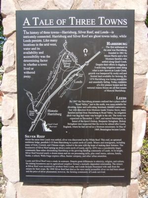
A Tale of Three Towns
Harrisburg
The first settlement in the area was Harrisburg, founded in 1861 by Moses Harris and a few Mormon families who settled along Quail Creek. Despite their efforts in digging a 5-mile-long irrigation canal along what is now known as Leeds Creek, growth was hampered by rocky soil and limited land available for farming. By 1876 Harrisburg was losing population and essentially failing. Today, remnants of a few pioneer homes and the restored Adams House are all that remain of Historic Harrisburg.
Leeds
In 1867 the Harrisburg pioneers realized that a place called "Road Valley", just to the north, was more suitable for diverting water and cultivating farmland. Amidst controversy, but with direction from Mormon leader Erastus Snow, many families moved from Harrisburg to Road Valley. An irrigation ditch was dug and water was brought to the site. The town was organized on December 1, 1867, and named Bennington, in honor of the town's bishop, Benjamin Stringham. Bishop Stringham later requested that the town be named after Leeds, England, where he had served as a Mormon missionary. In May of 1869, Bennington became Leeds.
Silver Reef
About the same time Leeds was settled, silver was discovered on the White Reef. This reef, an upturned sandstone ledge, parallels I-15 from Harrisburg to a point north of Leeds. Miners and immigrants, including many of Irish, Cornish, and Chinese origin, rushed to the area with the hope of making their fortunes. The boomtown of Silver Reef sprang up about a mile north of Leeds, and by 1878 was a considerably larger community than either diminishing Harrisburg or the growing farming community of Leeds. At its height, Silver Reef boasted nearly a dozen mines and six ore processing mills, plus retail stores, saloons, hotels, banks, a school, Wells Fargo express office, theater company, and other urban amenities.
Leeds and Silver Reef were a study in contrasts. Despite great differences in ethnicity, religion, and culture, the mining boomtown and its agricultural neighbor formed a mutually dependent relationship. The miners at Silver Reef were sustained by produce from Leeds, and Leeds farmers flourished with cash from the miners for their crops. By 1900 Silver Reef had died as the most easily accessible silver ore had been mined and the price of silver plummeted; however, the farming community of
Leeds survived.
Topics. This historical marker is listed in this topic list: Settlements & Settlers. A significant historical month for this entry is May 1869.
Location. 37° 14.323′ N, 113° 21.533′ W. Marker is in Leeds, Utah, in Washington County. Marker is on North Main Street (Utah Route 228), on the right when traveling north. Touch for map. Marker is at or near this postal address: 218 North Main Street, Leeds UT 84746, United States of America. Touch for directions.
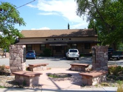
Other nearby markers. At least 8 other markers are within walking distance of this marker. From Schoolhouse to Town Hall (here, next to this marker); Water Is Life...The Shovel Is Divine (approx. 0.3 miles away); The Leeds Tithing Office (approx. 0.3 miles away); From Native American Trail to Interstate Exit (approx. 0.3 miles away); The Sarah Ann and William Stirling Home (approx. 0.3 miles away); Leeds CCC Camp (approx. 0.6 miles away); Leeds Historic CCC Camp (approx. 0.6 miles away); Civilian Conservation Corps, Leeds, Utah (approx. 0.6 miles away). Touch for a list and map of all markers in Leeds.
Credits. This page was last revised on June 16, 2016. It was originally submitted on September 21, 2012, by Bill Kirchner of Tucson, Arizona. This page has been viewed 476 times since then and 19 times this year. Photos: 1, 2. submitted on September 21, 2012, by Bill Kirchner of Tucson, Arizona. • Bill Pfingsten was the editor who published this page.

