Hays in Ellis County, Kansas — The American Midwest (Upper Plains)
Well House
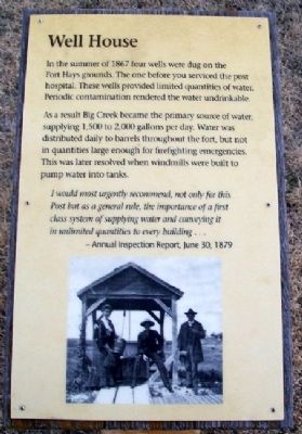
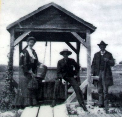
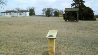
In the summer of 1867 four wells were dug on the Fort Hays grounds. The one before you serviced the post hospital. These wells provided limited quantities of water. Periodic contamination rendered the water undrinkable.
As a result Big Creek became the primary source of water, supplying 1,500 to 2,000 gallons per day. Water was distributed daily to barrels throughout the fort, but not in quantities large enough for firefighting emergencies. This was later resolved when windmills were built to pump water into tanks.
I would most urgently recommend, not only for this Post but as a general rule, the importance of a first class system of supplying water and conveying it in unlimited quantities to every building...
- Annual Inspection Report, June 30, 1879
Erected by Kansas Historical Society.
Topics. This historical marker is listed in these topic lists: Forts and Castles • Wars, US Indian. A significant historical date for this entry is June 30, 1872.
Location. 38° 51.7′ N, 99° 20.612′ W. Marker is in Hays, Kansas, in Ellis County. Marker is on the grounds of Fort Hays State Historic Site, off US Hwy 163 Alternate. Touch for map. Marker is at or near this postal address: 1472 US Highway 163 Alternate, Hays KS 67601, United States of America. Touch for directions.
Other nearby markers. At least 8 other markers are within walking distance of this marker. Buffalo Bill Cody (a few steps from this marker); Bake House (within shouting distance of this marker); Guardhouse (within shouting distance of this marker); Fort Hays Military Cemetery (within shouting distance of this marker); Sentinel Hill (within shouting distance of this marker); Officers in Tents (within shouting distance of this marker); Laundress' Quarters (within shouting distance of this marker); Outhouses (about 300 feet away, measured in a direct line). Touch for a list and map of all markers in Hays.
Also see . . .
1. Fort Hays State Historic Site. (Submitted on September 24, 2012, by William Fischer, Jr. of Scranton, Pennsylvania.)
2. Fort Hays State Historic Site. (Submitted on September 24, 2012, by William Fischer, Jr. of Scranton, Pennsylvania.)
Credits. This page was last revised on September 2, 2020. It was originally submitted on September 24, 2012, by William Fischer, Jr. of Scranton, Pennsylvania. This page has been viewed 500 times since then and 28 times this year. Photos: 1, 2, 3. submitted on September 24, 2012, by William Fischer, Jr. of Scranton, Pennsylvania.


