King City in Monterey County, California — The American West (Pacific Coastal)
Jolon
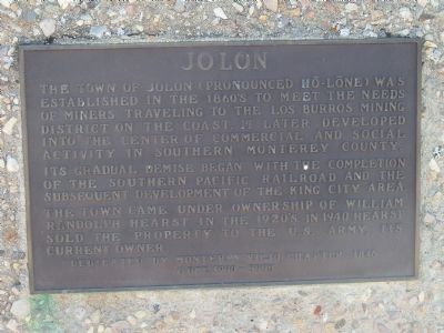
The town of Jolon (pronounced Hōe-Lōne) was established in the 1860s to meet the needs of miners traveling to the Los Burros Mining District on the coast. It later developed into the center of commercial and social activity in southern Monterey County.
Its gradual demise began with the completion of the Southern Pacific Railroad and the subsequent development of the King City area.
The town came under ownership of William Randolph Hearst in the 1920s. In 1940 Hearst sold the property to the U.S. Army, its current owner.
Erected 1990 by Monterey Viejo Chapter 1846, E Clampus Vitus.
Topics and series. This historical marker is listed in this topic list: Settlements & Settlers. In addition, it is included in the E Clampus Vitus series list. A significant historical year for this entry is 1940.
Location. 35° 58.25′ N, 121° 10.483′ W. Marker is in King City, California, in Monterey County. Marker is on Jolon Road (County Route G14) 0.2 miles north of Mission Road, on the left when traveling south. This marker is 300 feet east of Jolon Road on a short, unnamed, gravel, side road, 1200 feet south of the Dutton Hotel. Touch for map. Marker is in this post office area: King City CA 93930, United States of America. Touch for directions.
Other nearby markers. At least 7 other markers are within 13 miles of this marker, measured as the crow flies. Dutton Hotel (approx. ¼ mile away); Jose Mario Gil Adobe (approx. one mile away); The Hacienda (approx. 4.7 miles away); De Anza Expedition 1775 - 1776 (approx. 5.2 miles away); First Marriage in California (approx. 5.2 miles away); Lockwood (approx. 5.7 miles away); Pleyto (approx. 12.3 miles away).
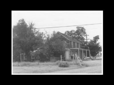
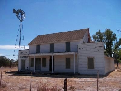
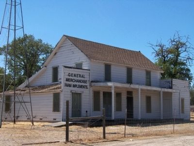
Regarding Jolon. This building is one of the few remaining buildings in Jolon - Determining that the local watering hole was an attractive nuisance, the Army bulldozed the road house and several other buildings at the intersection of Jolon Road and Mission Road in the late 1990s.
Also see . . . Jolon, California. Wikipedia entry. (Submitted on September 19, 2020, by Larry Gertner of New York, New York.)

Photographed By Neil Wollesen, July 27, 1975
4. Tidball (Jolon) Store; Jolon General Store
NPGallery Digital Asset Management System website entry
Click for more information.
Click for more information.
Credits. This page was last revised on October 3, 2021. It was originally submitted on September 25, 2012, by James King of San Miguel, California. This page has been viewed 703 times since then and 26 times this year. Photos: 1, 2, 3. submitted on September 25, 2012, by James King of San Miguel, California. 4. submitted on October 5, 2012. • Syd Whittle was the editor who published this page.


