Eureka Springs in Carroll County, Arkansas — The American South (West South Central)
The Civic Center
South Main
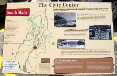
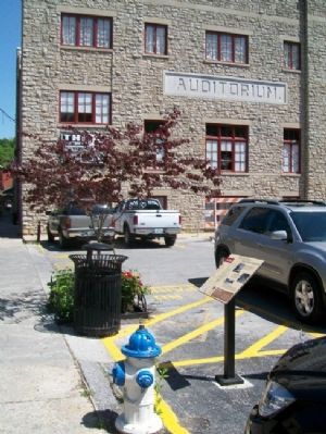
These two large limestone public buildings anchor this part of downtown Eureka Springs. They span the deep ravine cut by Leatherwood Creek which flows in a tunnel beneath all the buildings on this entire part of Main Street.
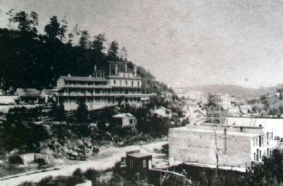
[Photo 1.]
This view shows South Main Street toward Basin Park in the 1890s before the Auditorium was built. The large Southern Hotel is shown in the center. This very early lodging survived all the great fires in the 1880s and 1890s which destroyed most of the town's early wooden buildings. It had grown to over 100 rooms when it too burned in 1933.
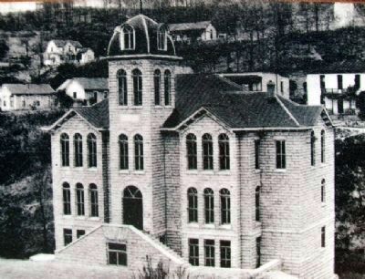
[Photo 2.]
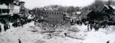
Carroll County Western District Courthouse is viewed here shortly after construction in 1908. Note the deep ravine on both sides. When the ravine was filled for parking, a "moat" was left around the lower level. A bronze plaque in front tells the Courthouse story.
[Photo 3.]
The whole town turned out for the Auditorium Groundbreaking Ceremony on April 11, 1928. This view is toward the north from the Courthouse. The Auditorium was opened by the John Philip Sousa Orchestra on September 13, 1929. It offered a spacious theater and a basement gymnasium which served local schools until the 1960s. It was renovated in 2005 with a matching U.S. Department of the Interior Save America's Treasures grant.
In The Neighborhood
Rock House Cave: Across from The Auditorium is a wooden stairway which is actually Rock House Avenue, a city street. Up the stairs, behind the building is Rock House Cave, viewed only from the stairway. It was said to be a hospital during the Civil War where injured soldiers were treated with water from Basin Spring. In early rough days of Eureka Springs, it was the popular Rock House Saloon.
Photographs courtesy of the Cornerstone Bank of Eureka Springs, Eureka Springs Historical Museum and the Eureka Springs Carnegie Public Library.
Topics. This historical marker is listed in these topic lists: Charity & Public Work • Environment • Government & Politics • Settlements & Settlers. A significant historical month for this entry is April 1880.
Location. 36° 24.057′ N, 93° 44.316′ W. Marker is in Eureka Springs, Arkansas, in Carroll County. Marker is on Main Street (State Highway 23) north of Benton Street, on the left when traveling south. Marker is north of the courthouse. Touch for map. Marker is at or near this postal address: 44 South Main Street, Eureka Springs AR 72632, United States of America. Touch for directions.
Other nearby markers. At least 8 other markers are within walking distance of this marker. The Western District Courthouse (a few steps from this marker); Civil War Healing (within shouting distance of this marker); Chandler Mall Buildings (about 300 feet away, measured in a direct line); "Mud" Street and "Underground Eureka" (about 300 feet away); Bank of Eureka Springs Community Room (about 300 feet away); The Southern Hotel (about 400 feet away); The Basin Bath House (about 400 feet away); The Basin Park Sycamore (about 400 feet away). Touch for a list and map of all markers in Eureka Springs.
Credits. This page was last revised on September 3, 2020. It was originally submitted on October 1, 2012, by William Fischer, Jr. of Scranton, Pennsylvania. This page has been viewed 526 times since then and 30 times this year. Photos: 1, 2, 3, 4, 5. submitted on October 1, 2012, by William Fischer, Jr. of Scranton, Pennsylvania.
