Congress in Yavapai County, Arizona — The American Mountains (Southwest)
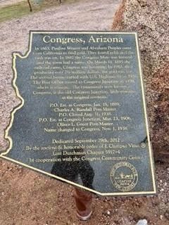
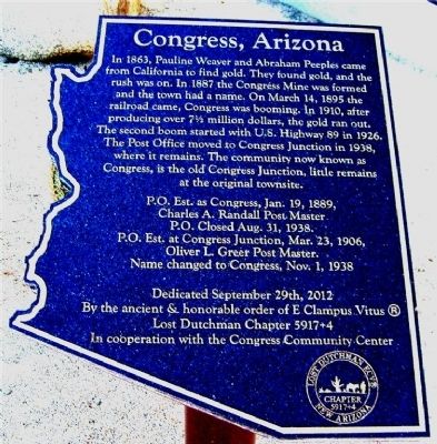
Congress, Arizona
Charles A. Randall Postmaster.
P.O. closed Aug 31, 1938.
P.O. Est. at Congress Junction Mar 23, 1906
Oliver L. Greer Post Master
Name changed to Congress Nov 1, 1938
Erected 2012 by Lost Dutchman chapter 5917+4, E Clampus Vitus in Cooperation with the Congress Community Center. Refusbished 2023.
Topics and series. This historical marker is listed in these topic lists: Notable Places • Settlements & Settlers. In addition, it is included in the E Clampus Vitus series list. A significant historical month for this entry is March 1843.
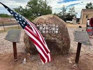
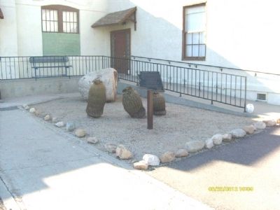
Location. 34° 9.673′ N, 112° 50.812′ W. Marker is in Congress, Arizona, in Yavapai County. Marker is on Santa Fe Road, on the right when traveling south. The marker is located at the entrance to the Congress Public Library, at the drilling rock (the large boulder). Touch for map. Marker is at or near this postal address: 26750 South Santa Fe Road, Congress AZ 85332, United States of America. Touch for directions.
Other nearby markers. At least 8 other markers are within 15 miles of this marker, measured as the crow flies. The Song of the “Peavine” (here, next to this marker); In Memory of Charles Churchill Small (approx. 5.4 miles away); Peeples Valley Pioneer Cemetery (approx. 10.9 miles away); Wickenburg Massacre (approx. 14 miles away); Vulture Mine (approx. 14.4 miles away); Garcia School (approx. 14.7 miles away); Henry Wickenburg (approx. 14.8 miles away); Everett Bowman (approx. 14.8 miles away). Touch for a list and map of all markers in Congress.
More about this marker. This marker was originally located at 34° 9.679′ N, 112° 50.838′ W, closer to the library building.
Credits. This page was last revised on November 9, 2023. It was originally submitted on October 2, 2012, by Frank Houdek of Kingman, Arizona. This page has been viewed 1,308 times since then and 56 times this year. Photos: 1, 2. submitted on November 9, 2023, by J. J. Prats of Powell, Ohio. 3, 4. submitted on October 2, 2012, by Frank Houdek of Kingman, Arizona. • Syd Whittle was the editor who published this page.


