Near Blackwood in Gordon County, Georgia — The American South (South Atlantic)
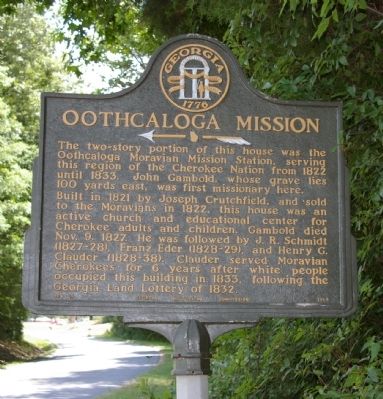
Oothcaloga Mission
←—«
The two-story portion of this house was the Oothcaloga Moravian Mission Station, serving this region of the Cherokee Nation from 1822 until 1833. John Gambold, whose grave lies 100 yards east, was first missionary here.
Built in 1821 by Joseph Crutchfield, and sold to the Moravians in 1822, this house was an active church and educational center for Cherokee adults and children. Gambold died Nov. 9, 1827. He was followed by J.R. Schimidt (1827-28), Franz Eder (1828~29), and Henry G. Clauder (1828~38). Clauder served Moravian Cherokee for 6 years after white people occupied this building in 1833, following the Georgia land lottery of 1832.
Erected 1959 by Georgia Historical Commission. (Marker Number 064-28.)
Topics and series. This historical marker is listed in these topic lists: Churches & Religion • Native Americans. In addition, it is included in the Georgia Historical Society series list. A significant historical month for this entry is October 1880.
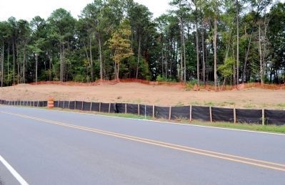
Location. Marker has been reported missing. It was located near 34° 26.81′ N, 84° 54.871′ W. Marker was near Blackwood, Georgia, in Gordon County. Marker was on Belwood Road, 1.6 miles south of Georgia Route 53, on the left when traveling south. Touch for map. Marker was in this post office area: Adairsville GA 30103, United States of America. Touch for directions.
Other nearby markers. At least 8 other markers are within 5 miles of this location, measured as the crow flies. Richard Peters Plantation (approx. 2˝ miles away); Cherokee Nation (approx. 2.6 miles away); Original Site Adairsville — 1830’s (approx. 3.6 miles away); Historic Liberty Cumberland Presbyterian Church (approx. 3.8 miles away); Liberty Church Grounds (approx. 3.8 miles away); Gordon County (approx. 4.4 miles away); The Calhoun Depot (approx. 4.4 miles away); a different marker also named Calhoun Depot (approx. 4.4 miles away).
More about this marker. There is construction work on Belwood Road in late 2012, possibly to widen the road, and the marker has been removed.
Also see . . . Photograph of Oothcaloga Moravian Mission. The mission building burned many years ago. This link contains a photo of the mission. (Submitted on September 3, 2008.)
Credits. This page was last revised on November 25, 2020. It was originally submitted on September 2, 2008, by David Seibert of Sandy Springs, Georgia. This page has been viewed 2,107 times since then and 24 times this year. Last updated on October 3, 2012, by David Seibert of Sandy Springs, Georgia. Photos: 1. submitted on September 2, 2008, by David Seibert of Sandy Springs, Georgia. 2. submitted on October 3, 2012, by David Seibert of Sandy Springs, Georgia. • Bill Pfingsten was the editor who published this page.

