Palo Seco in Toa Baja in Municipio de Toa Baja, Puerto Rico — The Caribbean (The West Indies)
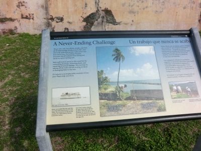
A Never-Ending Challenge / Un Trabajo Que Nunca Se Acaba
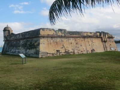
Wind, rain, salt, sun, plants, people and time all do what foreign invaders never did—tear down the stone and mortar walls at Fort San Juan de la Cruz. Preventing a historic structure like El Canuelo from falling into decay is a never-ending task. Park staff work to preserve this small fort by controlling drainage, removing plants, and repairing structural damage. You can help by staying off the walls and not writing on them or damaging them in any way.
El Canuelo is an irreplaceable reminder of our past. Please help care for it.
[Captions:]
San Juan de la Cruz, 1939
Water surrounded this fort until the U.S. Army built land around it in the 1940s. The structures on top are the remains of a 19th-century leprosy quarantine station.
Protecting Fort San Juan de la Cruz from relentless sun, wind, and rain requires constant care.
Volunteers pick up trash around El Cañuelo.
Un trabajo que nunca se acaba
Viento, lluvia, sal, sol, plantas, gente y tiempo; todo eso hace lo que invasores extranjeros nunca hicieron - arrancar la roca y el mortero de las murallas del Fortín San Juan de la Cruz. Prevenir que una estructura histórica como el Cañuelo se deteriore es una tarea interminable.
Las trabajadores del parque nacional se empeñan en preservar este fortín controlando el drenaje, removiendo la vegetación y reparando daños estructurales. Usted puede ayudar no subiendo a las murallas, no escribiendo en ellas o no dañándolas de cualquier otra forma.
El Cañuelo es un legado irremplazable de nuestro pasado. Ayúdenos a cuidarlo.
[Pie de dibujos:]
San Juan de la Cruz, 1939
Este fortín estaba rodeada de agua hasta que el ejército de EEUU rellenó de tierra su alrededor en la década de 1940-1949. Las estructuras en el tope son los restos de un asilo de leprosos del siglo XIX.
Proteger el Fortín San Juan de la Cruz del implacable sol, viento y lluvia requiere cuidado constante.
Voluntarios recogen basura alrededor de El Cañuelo.
Erected by National Park Service, U.S. Department of the Interior.
Topics. This historical marker is listed in this topic list: Forts and Castles. A significant historical year for this entry is 1939.
Location. 18° 27.972′ N, 66° 8.184′ W. Marker is in Toa Baja in Municipio de Toa Baja, Puerto Rico. It is in Palo Seco. Marker is on State Highway 870. Touch for map. Marker is in this post office area: Toa Baja PR 00949, United States of America. Touch for directions.
Other nearby markers. At least 8 other markers are within 3 kilometers of this marker, measured as the crow flies. Defending San Juan / Defensa de San Juan (a few steps from this marker); Crossfire / Fuego cruzado (within shouting distance of this marker); Imagine Life Here / Imagine Vivir Aquí (within shouting distance of this marker); The Main Plaza / Plaza principal (approx. 1.4 kilometers away); A Defense of the 1st Order (approx. 1.4 kilometers away); a different marker also named Defending San Juan / Defensa de San Juan (approx. 1.6 kilometers away); Juan Ponce de Leon (approx. 1.9 kilometers away); Piña Colada Made Famous (approx. 2 kilometers away). Touch for a list and map of all markers in Toa Baja.
Credits. This page was last revised on June 8, 2023. It was originally submitted on October 5, 2012, by Don Morfe of Baltimore, Maryland. This page has been viewed 460 times since then and 5 times this year. Photos: 1, 2, 3. submitted on October 5, 2012, by Don Morfe of Baltimore, Maryland. • Bill Pfingsten was the editor who published this page.


