Palo Seco in Toa Baja in Municipio de Toa Baja, Puerto Rico — The Caribbean (The West Indies)
Crossfire / Fuego cruzado
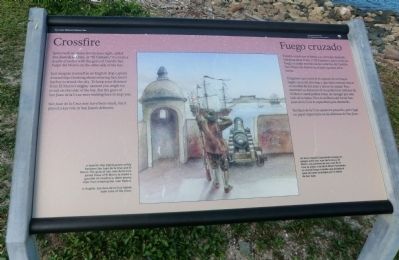
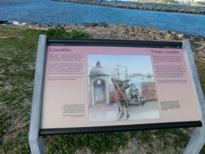
Just imagine yourself as an English ship captain around 1640 thinking about entering San Juan’s harbor to attack the city. To keep your distance from El Morro’s mighty cannon you might try to sail on this side of the bay. But the guns of San Juan de la Cruz were waiting here to stop you.
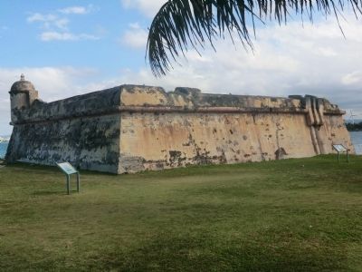
San Juan de la Cruz may have been small, but it played a key role in San Juan’s defenses.
Captions:
A Spanish ship (right) passes safely between San Juan de la Cruz and El Morro. The guns of San Juan de la Cruz joined those of El Morro to create a gauntlet of crossfire to deter enemy ships from entering San Juan Harbor.
In English, San Juan de la Cruz means Saint John of the Cross.
Español
Fuego cruzado
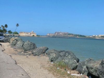
España construyó el fortín a su derecha, llamado San Juan de la Cruz, o "El Cañuelo," para crear un fuego cruzado mortal con los cañones de Castillo San Felipe del Morro en el lado opuesto de la bahía.
Imagínese que usted es el capitán de un buque inglés cerca del año 160 y que debe intentar entrar en la bahía de San Juan y atacar la ciudad. Para mantener su distancia de los poderosos cañones de El Morro usted podría tratar de navegar por este lado de la bahía. Pero la artillería del fortín San Juan de la Cruz lo esperaban para detenerlo.
San Juan de la Cruz quizá era pequeño, pero jugó un papel importante en las defensas de San Juan.
Pie de dibujo:
Un barco español (izquierda) navega sin peligro entre San Juan de la Cruz y El Morro. Los cañones de San Juan de la Cruz se unían a los de El Morro formando un mortal fuego cruzado que evitaba el paso de naves enemigas por la bahía de San Juan.
Erected by National Park Service.
Topics. This historical marker is listed in these topic lists: Colonial Era • Forts and Castles • Waterways & Vessels. A significant historical year for this entry is 1640.
Location. 18° 27.984′ N, 66° 8.196′ W. Marker is in Toa Baja in Municipio de Toa Baja, Puerto Rico. It is in Palo Seco. Marker is on State Highway 870. Touch for map. Marker is in this post office area: Toa Baja PR 00949, United States of America. Touch for directions.
Other nearby markers. At least 8 other markers are within 3 kilometers of this marker, measured as the crow flies. Defending San Juan / Defensa de San Juan (a few steps from this marker); A Never-Ending Challenge / Un Trabajo Que Nunca Se Acaba (within shouting distance of this marker); Imagine Life Here / Imagine Vivir Aquí (within shouting distance of this marker); The Main Plaza / Plaza principal (approx. 1.4 kilometers away); A Defense of the 1st Order (approx. 1.4 kilometers away); a different marker also named Defending San Juan / Defensa de San Juan (approx. 1.6 kilometers away); Juan Ponce de Leon (approx. 1.9 kilometers away); Piña Colada Made Famous (approx. 2.1 kilometers away). Touch for a list and map of all markers in Toa Baja.
Credits. This page was last revised on June 8, 2023. It was originally submitted on October 5, 2012, by Don Morfe of Baltimore, Maryland. This page has been viewed 388 times since then and 8 times this year. Photos: 1, 2, 3, 4, 5. submitted on October 5, 2012, by Don Morfe of Baltimore, Maryland. • Bill Pfingsten was the editor who published this page.
