Old Town in Alexandria, Virginia — The American South (Mid-Atlantic)
D.C.'s First Building Block
Jones Point Park
— National Park Service, U.S. Department of the Interior —
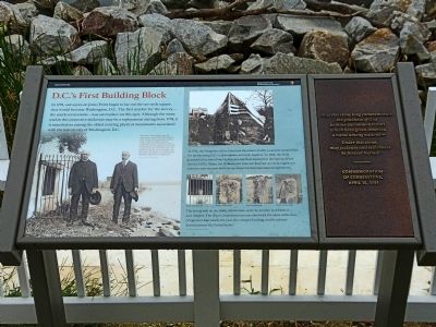
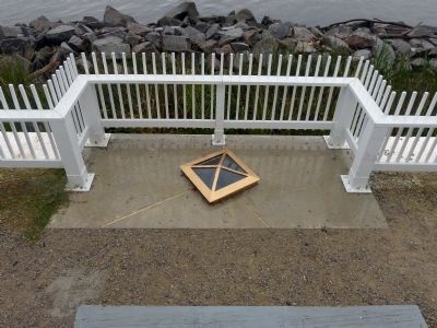
In 1791, surveyors on Jones Point began to lay out the ten-mile square that would become Washington, D.C. The first marker for the survey—the south cornerstone—was set in place on this spot. Although the stone within this protective enclosure may be a replacement dating from 1794, it is nonetheless among the oldest existing physical monuments associated with the federal city of Washington, D.C.
[Caption:]
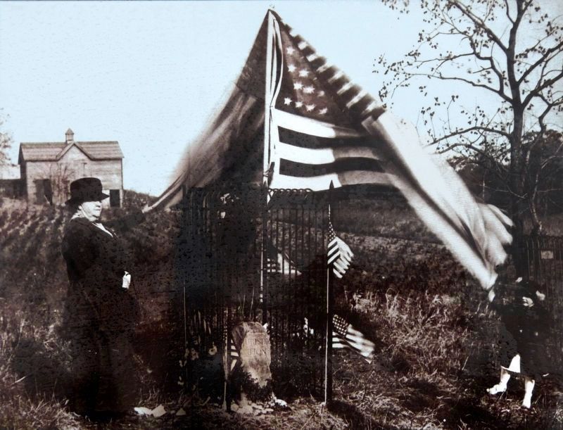
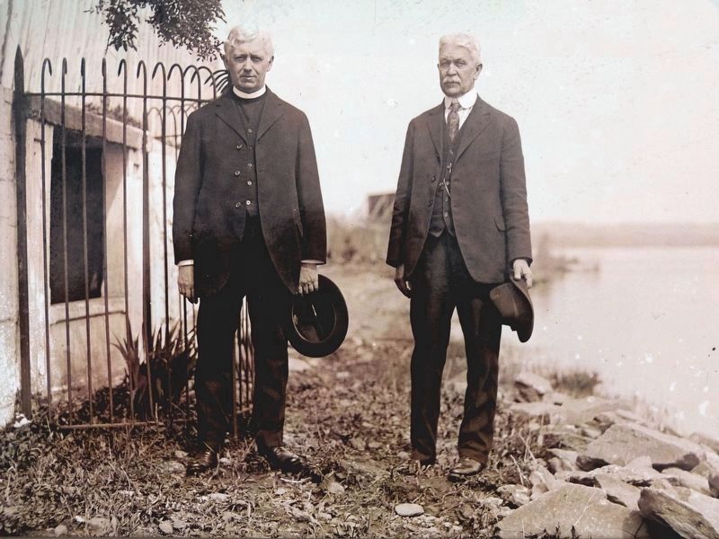
With water levels steadily rising, the cornerstone on Jones Point has long been at the mercy of encroaching Hunting Creek. In 1861, a retaining wall was constructed in front of the stone, creating a raised yard in the lighthouse constructed six years earlier. The stone remained "lost" behind this wall for over five decades. This 1921 photo was taken at a commemorative celebration following its "rediscovery." Image courtesy of the Library of Congress
[Sidebar:]
In 1916, the Daughters of the American Revolution (DAR) assumed responsibility for maintaining D.C.'s cornerstones and mile markers. In 1926, the DAR purchased the Jones Point lighthouse and later deeded it to the National Park Service (NPS). Today, the DAR and the National Park Service work together to preserve and interpret both the south cornerstone and the adjacent lighthouse. Image courtesy of the Daughters of the American Revolution
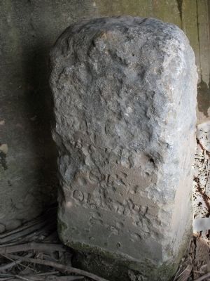
The inscription on the south cornerstone, worn by weather and water is now illegible. The other cornerstones are inscribed with the name of the state (Virginia or Maryland), the year, the compass heading, and the phrase 'Jurisdiction of the United States.' Images courtesy of the Library of Congress
[Sidebar:]
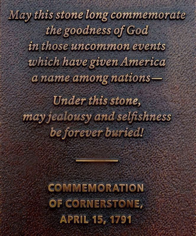
May this stone long commemorate the goodness of God in those uncommon events which have given America a name among nations—
Under this stone may jealousy and selfishness be forever buried!
Commemoration of Cornerstone April 15, 1791
Erected 2012 by National Park Service, U.S. Department of the Interior.
Topics and series. This historical marker is listed in this topic list: Political Subdivisions. In addition, it is included in the Lighthouses, and the Original Federal Boundary Stones series lists. A significant historical year for this entry is 1791.
Location. 38° 47.42′ N, 77° 2.436′ W. Marker is in Alexandria, Virginia. It is in Old Town. Marker can be reached from Jones Point Drive east of South Royal Street, on the right when traveling east. On the seawall of Jones Point lighthouse. Touch for map. Marker is in this post office area: Alexandria VA 22314, United States of America. Touch for directions.
Other nearby markers. At least 8 other markers are within walking
distance of this marker. The Nation's Capital Begins Here 1791-1793 (here, next to this marker); Who Owns the River? (within shouting distance of this marker); Mistress Margaret Brent (within shouting distance of this marker); The Remarkable Margaret Brent (within shouting distance of this marker); The Jones Point Lighthouse (within shouting distance of this marker); The Long Story of The Jones Point Ropewalk (about 400 feet away, measured in a direct line); Mountains of Materials and Massive Manpower (about 700 feet away); A World War I Shipyard Transforms Jones Point (about 800 feet away). Touch for a list and map of all markers in Alexandria.
Photographed By Allen C. Browne, October 7, 2012
5. Fred Woodward (on the right) and an unknown clergyman
With water levels steadily rising, the cornerstone on Jones Point has long been at the mercy of the encroaching Hunting Creek. In 1861, a retaining wall was constructed in front of the stone, creating a raised yard for the lighthouse constructed six years earlier. The stone remained “lost” behind this wall for over five decades. This 1921 photo was taken at a commemorative celebration following its “rediscovery.”Close-up of Library of Congress photo on marker
Photographed By Allen C. Browne, October 7, 2012
7. Commemoration of Cornerstone, April 15, 1791.
the goodness of God
in those uncommon events
which have given America
a name among nations—
Under this stone,
may jealousy and selfishness
be forever buried!
---------
Commemoration
of Cornerstone
April 15, 1791
The words of Rev. James Muir, delivered at the dedication of the South Cornerstone, appear on a bronze plaque mounted on the marker.
Credits. This page was last revised on January 28, 2023. It was originally submitted on October 8, 2012, by Allen C. Browne of Silver Spring, Maryland. This page has been viewed 1,064 times since then and 54 times this year. Photos: 1, 2, 3. submitted on October 8, 2012, by Allen C. Browne of Silver Spring, Maryland. 4, 5, 6. submitted on October 16, 2019, by Allen C. Browne of Silver Spring, Maryland. 7. submitted on April 16, 2021, by Allen C. Browne of Silver Spring, Maryland. • Bernard Fisher was the editor who published this page.
