Beaver Township near Conneautville in Crawford County, Pennsylvania — The American Northeast (Mid-Atlantic)
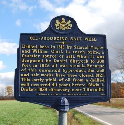
Oil-Producing Salt Well
Erected 1985 by Pennsylvania Historical and Museum Commission.
Topics and series. This historical marker is listed in this topic list: Industry & Commerce. In addition, it is included in the Pennsylvania Historical and Museum Commission series list. A significant historical year for this entry is 1815.
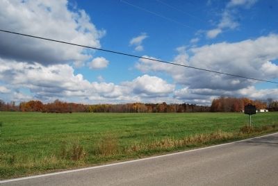
Location. 41° 45.915′ N, 80° 29.521′ W. Marker is near Conneautville, Pennsylvania, in Crawford County. It is in Beaver Township. Marker is on Pierpoint Road (Pennsylvania Route 198) 0.3 miles east of Reeds Corner Road. Touch for map. Marker is at or near this postal address: 31218 Pierpoint Road, Conneautville PA 16406, United States of America. Touch for directions.
Other nearby markers. At least 8 other markers are within 12 miles of this marker, measured as the crow flies. In Memory of Those (approx. 4.1 miles away in Ohio); Erie Extension Canal (approx. 6.1 miles away); Old Brick Stagecoach Inn & Tavern (approx. 9.1 miles away in Ohio); Veterans Memorial (approx. 9.1 miles away in Ohio); Tornado of May 31, 1985 (approx. 11.1 miles away); a different marker also named Erie Extension Canal (approx. 11.2 miles away); a different marker also named Veterans Memorial (approx. 11.2 miles away); Albion Winegar Tourgée (approx. 11½ miles away in Ohio).
Also see . . . Oil-Producing Salt Well - Behind the Marker. ExplorePAHistory.com (Submitted on October 22, 2012, by Mike Wintermantel of Pittsburgh, Pennsylvania.)
Credits. This page was last revised on February 7, 2023. It was originally submitted on October 21, 2012, by Mike Wintermantel of Pittsburgh, Pennsylvania. This page has been viewed 527 times since then and 20 times this year. Photos: 1, 2. submitted on October 21, 2012, by Mike Wintermantel of Pittsburgh, Pennsylvania.

