Newkirk in Kay County, Oklahoma — The American South (West South Central)
Newkirk
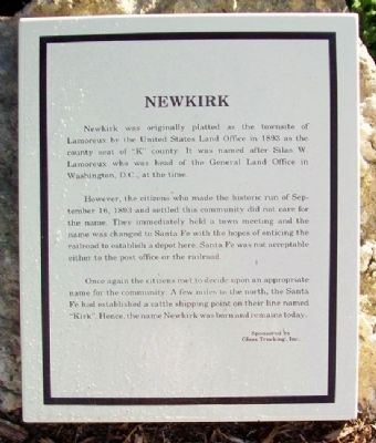
Newkirk was originally platted as the townsite of Lamoreux by the United States Land Office in 1893 as the county seat of "K" county. It was named after Silas W. Lamoreaux who was the head of the General Land Office in Washington, D.C., at the time.
However, the citizens who made the historic run of September 16, 1893 and settled this community did not care for the name. They immediately held a town meeting and the name was changed to Santa Fe with the hopes of enticing the railroad to establish a depot here. Santa Fe was not acceptable to the post office or the railroad.
Once again the citizens met to decide upon an appropriate name for the community. A few miles to the north, the Santa Fe had established a cattle shipping point on their line named "Kirk". Hence, the name Newkirk was born and remains today.
Erected by Glass Trucking, Inc.
Topics. This historical marker is listed in these topic lists: Man-Made Features • Railroads & Streetcars • Settlements & Settlers. A significant historical month for this entry is September 1807.
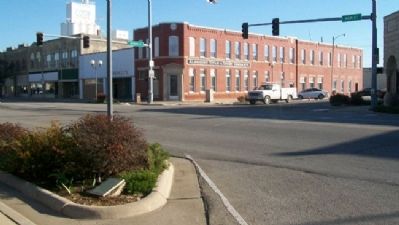
Location. 36° 52.935′ N, 97° 3.224′ W. Marker is in Newkirk, Oklahoma, in Kay County. Marker is at the intersection of Main Street (U.S. 77) and 7th Street, on the left when traveling north on Main Street. Touch for map. Marker is in this post office area: Newkirk OK 74647, United States of America. Touch for directions.
Other nearby markers. At least 8 other markers are within walking distance of this marker. Newkirk Kay County Fair (a few steps from this marker); Oklahoma State Centennial 1907 - 2007 (within shouting distance of this marker); First National Bank (within shouting distance of this marker); Cherokee Allotments (within shouting distance of this marker); Fire of 1901 (within shouting distance of this marker); Kay County Abstract Building (within shouting distance of this marker); The Cline Building (within shouting distance of this marker); Land of Hope (about 400 feet away, measured in a direct line). Touch for a list and map of all markers in Newkirk.
Credits. This page was last revised on September 24, 2020. It was originally submitted on October 22, 2012, by William Fischer, Jr. of Scranton, Pennsylvania. This page has been viewed 444 times since then and 15 times this year. Photos: 1, 2. submitted on October 22, 2012, by William Fischer, Jr. of Scranton, Pennsylvania.

