Newkirk in Kay County, Oklahoma — The American South (West South Central)
Cherokee Allotments
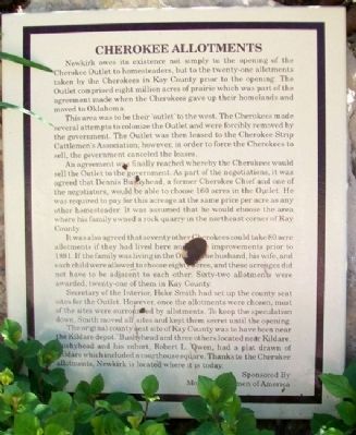
Newkirk owes its existence not simply to the opening of the Cherokee Outlet to homesteaders, but to the twenty-one allotments taken by the Cherokees in Kay County prior to the opening. The Outlet comprised eight million acres of prairie which was part of the agreement made when the Cherokees gave up their homelands and moved to Oklahoma.
This area was to be their outlet to the west. The Cherokees made several attempts to colonize the Outlet and were forcibly removed by the government. The Outlet was then leased to the Cherokee Strip Cattlemen's Association; however, in order to force the Cherokees to sell, the government canceled the leases.
An agreement was finally reached whereby the Cherokees would sell the Outlet to the government. As part of the negotiations, it was agreed that Dennis Bushyhead, a former Cherokee Chief and one of the negotiators, would be able to choose 160 acres in the Outlet. He was required to pay for this acreage at the same price per acre as any other homesteader. It was assumed that he would choose the area where his family owned a rock quarry in the northeast corner of Kay County.
It was also agreed that seventy other Cherokees could take 80 acre allotments if they had lived here and made improvements prior to 1891. If the family was living in the Outlet, the husband, his wife, and each child were allowed to choose eighty acres, and these acreages did not have to be adjacent to each other. Sixty-two allotments were awarded, twenty-one of them in Kay County.
Secretary of the Interior, Hoke Smith had set up the county seat sites for the Outlet. However, once the allotments were chosen, most of the sites were surrounded by allotments. To keep the speculation down, Smith moved all sites and kept them secret until the opening.
The original county seat site of Kay County was to have been near the Kildare depot. Bushyhead and three others located near Kildare. Bushyhead and his cohort, Robert L. Owen, had a plat drawn of Kildare which included a courthouse square. Thanks to the Cherokee allotments, Newkirk is located where it is today.
Erected by Modern Woodmen of America.
Topics. This historical marker is listed in these topic lists: Government & Politics • Native Americans • Settlements & Settlers. A significant historical year for this entry is 1891.
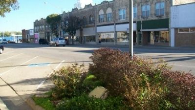
Location. 36° 52.955′ N, 97° 3.223′ W. Marker is in Newkirk, Oklahoma, in Kay County. Marker is at the intersection of Main Street (U.S. 77) and 7th Street, on the left when traveling north on Main Street. Touch for map. Marker is in this post office area: Newkirk OK 74647, United States of America. Touch for directions.
Other nearby markers. At least 8 other markers are within walking distance
of this marker. First National Bank (a few steps from this marker); Fire of 1901 (a few steps from this marker); The Cline Building (within shouting distance of this marker); Newkirk (within shouting distance of this marker); Newkirk Kay County Fair (within shouting distance of this marker); Oklahoma State Centennial 1907 - 2007 (within shouting distance of this marker); Kay County Abstract Building (within shouting distance of this marker); Land of Hope (about 500 feet away, measured in a direct line). Touch for a list and map of all markers in Newkirk.
Also see . . . Cherokee Nation Official Website. (Submitted on October 22, 2012, by William Fischer, Jr. of Scranton, Pennsylvania.)
Credits. This page was last revised on September 24, 2020. It was originally submitted on October 22, 2012, by William Fischer, Jr. of Scranton, Pennsylvania. This page has been viewed 460 times since then and 20 times this year. Photos: 1, 2. submitted on October 22, 2012, by William Fischer, Jr. of Scranton, Pennsylvania.

