Carsac-Aillac in Dordogne, New Aquitaine, France — Western Europe
Perigord Noir
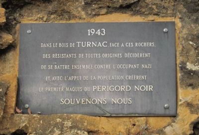
1943
Dans le bois de Turnac, face a ces rochers, des rèsistants de toutes origines décidèrent de se battre ensemble contre l’occupant nazi et, avec l’appui de la population créèrent le premier maquis de Perigord Noir Souvenons Nous
1943
In the Turnac Woods, facing these rocks, resistance fighters of all origins decided to fight together against the Nazi occupation, and with the support of the people created the first underground of Perigord Noir We remember
Topics. This memorial is listed in this topic list: War, World II. A significant historical year for this entry is 1943.
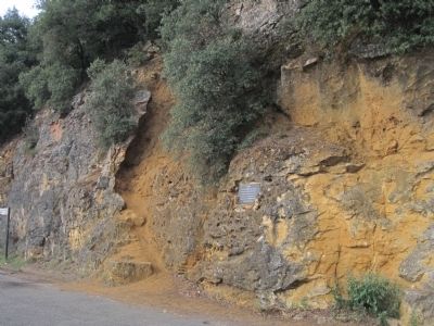
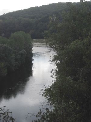
Location. 44° 50.606′ N, 1° 15.547′ E. Marker is in Carsac-Aillac, Nouvelle-Aquitaine (New Aquitaine), in Dordogne. Memorial is on D 703. This marker is on the rocks, opposite the Dordogne River overlook on road D 703 between the villages Carsac-Aillac and Montfort. Touch for map. Marker is in this post office area: Carsac-Aillac, Nouvelle-Aquitaine 24200, France. Touch for directions.
Other nearby markers. At least 8 other markers are within 6 kilometers of this marker, measured as the crow flies. Jacques de Maleville (approx. 5.7 kilometers away); Jacquou le Croquant (approx. 5.8 kilometers away); Lanterne des Morts (approx. 6 kilometers away); Hôtel de Cervalè (approx. 6.1 kilometers away); Palais Épiscopal (approx. 6.1 kilometers away); Eglise Saint-Sacerdos (approx. 6.1 kilometers away); Hôtel de Carbonnier de Marzac (approx. 6.1 kilometers away); Hôtel de Grézel (approx. 6.1 kilometers away).
Also see . . . French Resistance. (Submitted on October 17, 2012, by Barry Swackhamer of Brentwood, California.)
Credits. This page was last revised on September 11, 2018. It was originally submitted on October 17, 2012, by Barry Swackhamer of Brentwood, California. This page has been viewed 501 times since then and 15 times this year. Last updated on October 24, 2012. Photos: 1, 2, 3. submitted on October 17, 2012, by Barry Swackhamer of Brentwood, California. • Bill Pfingsten was the editor who published this page.


