Near Talking Rock in Pickens County, Georgia — The American South (South Atlantic)
Old Federal Road
Inscription.
The highway leading right is the Old Federal Road, northwest Georgia’s earliest vehicular route. It began on the Cherokee boundary, in the direction of Athens, Georgia and led this was to Tennessee. Permission to open the trace was granted informally by the Indians in 1803 and formally by the 1805 Treaty of Tellico, Tennessee.
This location on the old thoroughfare was a Cherokee settlement known as Sanderstown. It was an early post office and the site of Carmel or Taloney Station, a missionary establishment founded here among the Cherokees in 1821.
Erected 1954 by Georgia Historical Commission. (Marker Number 112-3A.)
Topics and series. This historical marker is listed in these topic lists: Native Americans • Roads & Vehicles. In addition, it is included in the Georgia Historical Society series list. A significant historical year for this entry is 1803.
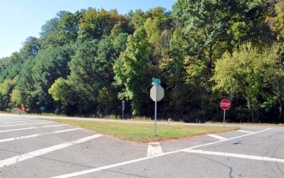
Location. Marker has been reported missing. It was located near 34° 31.183′ N, 84° 31.4′ W. Marker was near Talking Rock, Georgia, in Pickens County. Marker was at the intersection of Ellijay Road (Old Georgia Route 5) and Georgia Route 136, in the median on Ellijay Road. Touch for map. Marker was in this post office area: Talking Rock GA 30175, United States of America. Touch for directions.
Other nearby markers. At least 8 other markers are within 7 miles of this location, measured as the crow flies. Site of Carmel (Taloney) Mission Station (within shouting distance of this marker); The Zell Miller Mountain Parkway (approx. 1.6 miles away); The Kirby-Quinton Cabin (approx. 6.3 miles away); Oglethorpe Monument (approx. 6.3 miles away); The Old Pickens County Jail (approx. 6.3 miles away); a different marker also named Old Pickens County Jail (approx. 6.3 miles away); Pickens County (approx. 6.4 miles away); a different marker also named Old Federal Road (approx. 6.4 miles away). Touch for a list and map of all markers in Talking Rock.
More about this marker. The marker was observed standing in the early 1990s.
The text for the missing marker was taken from Georgia Historical Markers (Bay Tree Grove, Second Edition 1978) compiled by Carroll P. Scruggs from the records of the Georgia Historical Commission.
Credits. This page was last revised on June 16, 2016. It was originally submitted on October 24, 2012, by David Seibert of Sandy Springs, Georgia. This page has been viewed 612 times since then and 20 times this year. Photos: 1, 2. submitted on October 24, 2012, by David Seibert of Sandy Springs, Georgia. • Craig Swain was the editor who published this page.
Editor’s want-list for this marker. Photo of marker before going missing? • Can you help?

