Near Spotsylvania Courthouse in Spotsylvania County, Virginia — The American South (Mid-Atlantic)
Widow Tapp’s Field
Battle of the Wilderness
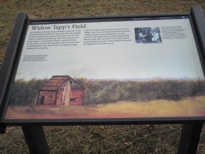
Catherine Tapp’s net worth barely exceeded 100 dollars. She owned no land; she owned no slaves. A kitchen garden and small patch of corn, potatoes, and wheat likely provided much of the family’s food. The war that so devastated others in Spotsylvania County could do little to diminish the Tapps; they had little to lose.
Erected by National Park Service, U.S. Department of the Interior.
Topics. This historical marker is listed in these topic lists: Agriculture • War, US Civil • Women.
Location. 38° 17.665′ N, 77° 43.484′ W. Marker is near Spotsylvania Courthouse, Virginia, in Spotsylvania County. Marker is on Hill-Ewell Drive, on the right when traveling south. Marker is in the Wilderness Battlefield at Tour Stop 6. Touch for map. Marker is at or near this postal address: 13213 Wilderness Park Dr, Spotsylvania VA 22551, United States of America. Touch for directions.
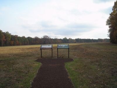
Other nearby markers. At least 8 other markers are within walking distance of this marker. Crisis in Tapp Field (here, next to this marker); Brink of Victory (approx. 0.2 miles away); The Widow Tapp House (approx. 0.2 miles away); The Home of Widow Tapp (approx. 0.2 miles away); Lee to the Rear! (approx. ¼ mile away); Col. James D. Nance (approx. ¼ mile away); Texas (approx. ¼ mile away); Lee to the rear! (approx. ¼ mile away). Touch for a list and map of all markers in Spotsylvania Courthouse.
More about this marker. The marker's background is a painting with the caption A postwar painting of Widow Tapp’s cabin. Tapp rented the farm from James Horace Lacy, who lived at Ellwood, two miles northeast of here.
In the upper right of the marker is a photograph of a witness to the Battle of the Wilderness. Eliza “Phenie” Tapp was just four at the time of the battle, but in the 1930s she described her childhood memories to National Park Service historian Ralph Happel. She remembered that as her family fled their home bullets struck the dirt around them, kicking up dust like the first raindrops of a coming storm.
Also see . . . Battle of the Wilderness. (Submitted on March 8, 2008, by Bill Coughlin of Woodland Park, New Jersey.)

Photographed By Craig Swain, February 16, 2008
4. The Tapp Fields
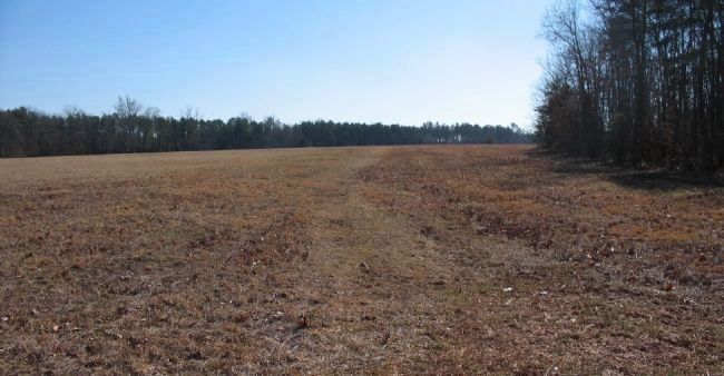
The park has restored some of the original boundaries of the Tapp fields. Open ground to the west of the marker location were farmed by the Tapp family at the time of the battle. Residential development has covered many sectors of the battlefield. A substantial subdivision now stands to the north of the marker, on the opposite side of the road from this view.
Credits. This page was last revised on July 9, 2021. It was originally submitted on March 8, 2008, by Bill Coughlin of Woodland Park, New Jersey. This page has been viewed 2,645 times since then and 51 times this year. Photos: 1, 2, 3. submitted on March 8, 2008, by Bill Coughlin of Woodland Park, New Jersey. 4. submitted on March 9, 2008, by Craig Swain of Leesburg, Virginia. • Craig Swain was the editor who published this page.


