Sierra Blanca in Hudspeth County, Texas — The American South (West South Central)
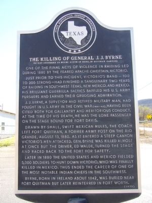
The Killing of General J. J. Byrne
(Event occurred 15 miles south of here, in Quitman Canyon)
Just prior to this incident, Victorio's band--100 to 200 strong-- had finished a sanguinary two years of raiding in southwest Texas, New Mexico, and Mexico. His brilliant guerrilla tactics baffled his U. S. Army pursuers and earned their grudging admiration.
J. J. Byrne, a surveyor and retired military man, had fought in U. S. Army in the Civil War (1861-65), having been cited both for gallantry and meritorious conduct. At the time of his death, he was the lone passenger on the stage bound for Fort Davis.
Drawn by small, swift Mexican mules, the coach left Fort Quitman, a former Army post on the Rio Grande, August 13, 1880. As it entered a steep canyon Victorio's men attacked. Gen. Byrne was killed almost at once but the driver, Ed Walde, turned the stage and raced back to the fort for safety.
Later in 1880 the United States and Mexico fielded 5,000 soldiers to hunt down Victorio, who was finally killed in Mexico. Thus ended the career of one of the most notable Indian chiefs in the southwest.
Byrne, born in Ireland about 1842, was buried near Fort Quitman but later reinterred in Fort Worth.
Erected 1973 by State Historical Survey Committee. (Marker Number 5367.)
Topics. This historical marker is listed in this topic list: Wars, US Indian. A significant historical date for this entry is August 13, 1880.
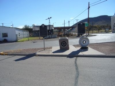
Location. 31° 10.477′ N, 105° 21.442′ W. Marker is in Sierra Blanca, Texas, in Hudspeth County. Marker is at the intersection of Ranch to Market Road 1111 and Business Route 10, on the right when traveling north on Route 1111. Touch for map. Marker is in this post office area: Sierra Blanca TX 79851, United States of America. Touch for directions.
Other nearby markers. At least 7 other markers are within 9 miles of this marker, measured as the crow flies. Hudspeth County (here, next to this marker); America's Second Transcontinental Railroad (here, next to this marker); Sierra Blanca Methodist Church (approx. 0.2 miles away); Fort Quitman (approx. 0.4 miles away); Hudspeth County Courthouse (approx. 0.4 miles away); August Fransal (approx. 0.6 miles away); Claude Hudspeth (approx. 8˝ miles away).
Credits. This page was last revised on June 4, 2018. It was originally submitted on October 31, 2012, by Bill Kirchner of Tucson, Arizona. This page has been viewed 729 times since then and 29 times this year. Last updated on June 4, 2018, by Brian Anderson of Humble, Texas. Photos: 1, 2. submitted on October 31, 2012, by Bill Kirchner of Tucson, Arizona. • Andrew Ruppenstein was the editor who published this page.

