Coffeyville in Montgomery County, Kansas — The American Midwest (Upper Plains)
Dalton Gang and Defenders Graves
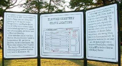
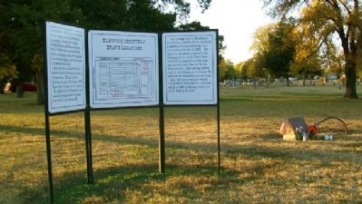
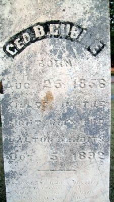
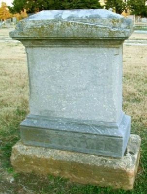
On October 5, 1892, the five-member Dalton Gang rode into Coffeyville planning to rob the two banks. George Cubine and Charles Brown, two of Coffeyville's citizens killed while defending their town against the notorious gang, are buried here in Elmwood Cemetery.
Other defenders killed were City Marshal Charles Connelly, buried in Independence, KS, and Lucius Baldwin, buried in Burlington, KS. Three other citizens were wounded.
The family of Dick Broadwell, the remaining gang member, took his body back to Hutchinson, KS.
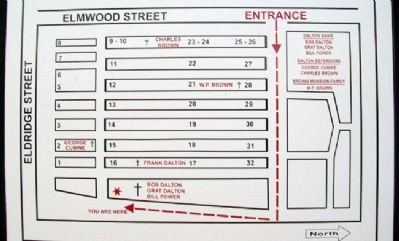
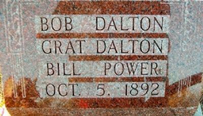
Just north of here lies Bob Dalton, Grat Dalton, and Bill Powers, killed by Coffeyville citizens defending their two banks on October 5, 1892. The pipe near the grave, originally the hitching rail to which their horses were tied in Death Alley, was their only marker until until Emmett Dalton was pardoned - after serving fifteen years in the Kansas penitentiary. He installed the headstone you see today.
Also, 100 yards straight west is the grave of Frank Dalton, a brother, killed in 1887 in the line of duty as a U.S. Deputy Marshal.
Topics. This historical marker is listed in these topic lists: Cemeteries & Burial Sites • Disasters • Peace • Settlements & Settlers. A significant historical date for this entry is October 5, 1892.
Location. 37° 1.349′ N, 95° 37.095′ W. Marker is in Coffeyville, Kansas, in Montgomery County. Marker is in the southeast corner of Elmwood Cemetery. Touch for map. Marker is at or near this postal address: 1701 Elmwood Drive, Coffeyville KS 67337, United States of America. Touch for directions.
Other nearby markers. At least 8 other markers are within walking distance of this marker. Robb (about 500 feet away, measured in a direct line); Civil War Memorial (about 800 feet away); Bethel AME Church (approx. 0.7 miles away); William Howard Taft (approx. 0.9 miles away); Charles T. Connelly (approx. 0.9 miles away); Historic Downtown Plaza (approx. 0.9 miles away); Perkins Building (approx. 0.9 miles away); Lucius M. Baldwin (approx. 0.9 miles away). Touch for a list and map of all markers in Coffeyville.
Also see . . .
1. Dalton Defenders. Chamber of Commerce website entry (Submitted on November 3, 2012, by William Fischer, Jr. of Scranton, Pennsylvania.)
2. The Dalton Gang's Last Raid, 1892. Eyewitness to History website entry (Submitted on November 3, 2012, by William Fischer, Jr. of Scranton, Pennsylvania.)
3. Coffeyville, Kansas: The Town That Stopped the Dalton Gang. National Park Service website entry (Submitted on November 3, 2012, by William Fischer, Jr. of Scranton, Pennsylvania.)
Credits. This page was last revised on January 24, 2022. It was originally submitted on November 3, 2012, by William Fischer, Jr. of Scranton, Pennsylvania. This page has been viewed 1,046 times since then and 56 times this year. Photos: 1, 2, 3, 4, 5, 6. submitted on November 3, 2012, by William Fischer, Jr. of Scranton, Pennsylvania.
