Springfield in Fairfax County, Virginia — The American South (Mid-Atlantic)
Ravensworth
Temporary Safe Haven
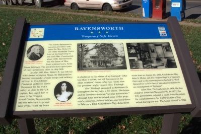
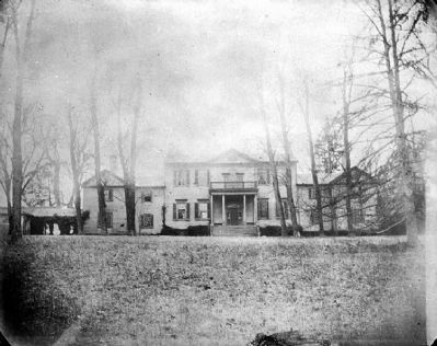
The nearby Ravensworth mansion provided a safe haven for Mrs. Robert E. Lee (Mary Randolph Custis Lee) at the beginning of the Civil War. Constructed about 1796, Ravensworth was the home of Mrs. Lee’s widowed aunt, Anna Maria Fitzhugh. The newlywed Lees spent part of their honeymoon there in July 1831.
In May 1861, Gen. Robert E. Lee left his wife’s home, Arlington House, for Richmond to become commander of state troops and military advisor to Confederate President Jefferson Davis. Concerned for his wife’s safety so close to the U.S. capital, Lee urged her to move to her “Cousin Anna’s” home, Ravensworth. She was reluctant to go and later wrote, “I left my home in obedience to the wishes of my husband.” After less than a month, she left Ravensworth for other relatives’ homes after Lee wrote that her presence might imperil Mrs. Fitzhugh.
Mrs. Fitzhugh remained at Ravensworth throughout the war with a few slaves. The house and its occupants escaped “serious molestation,” although both armies seized some of the property’s resources. Federal soldiers cut wood there in February 1863. Confederate Maj. John Scott wrote that on August 23,1863, Confederate Maj. John S. Mosby and his rangers slept in a haystack there and in the morning were shocked to “find themselves in full view of and close proximity to an encampment of Yankees.”
After Mrs. Fitzhugh died in 1874, the Lee children inherited Ravensworth. In 1877, the U.S. government rejected a claim from the estate for reimbursement for 3,000 pounds of hay seized during the war. The house burned in 1926.
Erected by Virginia Civil War Trails.
Topics. This historical marker is listed in this topic list: War, US Civil. A significant historical month for this entry is February 1863.
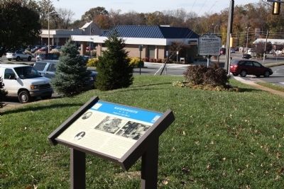
Location. 38° 48.565′ N, 77° 13.252′ W. Marker is in Springfield, Virginia, in Fairfax County. Marker is on Port Roal Road just south of Braddock Road (County Route 620), on the right when traveling south. Port Royal Road is on the west side of the intersection of Braddock Road and the Capital Beltway (Interstate 495). Touch for map. Marker is at or near this postal address: 5236 Port Royal Rd, Springfield VA 22151, United States of America. Touch for directions.
Other nearby markers. At least 8 other markers are within 2 miles of this marker, measured as the crow flies. A different marker also named Ravensworth (within shouting distance of this marker); Connecting Communities and Parks (approx. 1.1 miles away); Orange and Alexandria Railroad (approx. 1.2 miles away); The Civilian Conservation Corps (approx. 1.4 miles away); a different marker also named Orange and Alexandria Railroad (approx. 1½ miles away); Mosby Attacks Annandale (approx. 1.7 miles away); Price’s Ordinary (approx. 1.9 miles away); Little River Turnpike (approx. 2 miles away). Touch for a list and map of all markers in Springfield.
Credits. This page was last revised on January 27, 2022. It was originally submitted on November 4, 2012, by J. J. Prats of Powell, Ohio. This page has been viewed 1,505 times since then and 43 times this year. Photos: 1, 2, 3. submitted on November 4, 2012, by J. J. Prats of Powell, Ohio.


