Terlingua in Brewster County, Texas — The American South (West South Central)
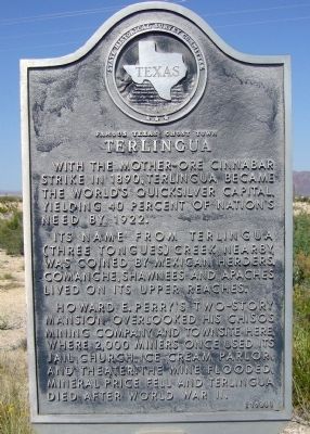
Terlingua
Famous Texas Ghost Town
Its name from Terlingua (three tongues) creek nearby, was coined by Mexican herders. Comanche, Shawnees and Apaches lived on its upper reaches.
Howard E. Perry's two-story mansion overlooked his Chisos Mining Company and townsite here, where 2,000 miners once used its jail, church, ice cream parlor and theater. The mine flooded, mineral price fell and Terlingua died after World War II.
Erected 1966 by State Historical Survey Committee. (Marker Number 6478.)
Topics. This historical marker is listed in these topic lists: Industry & Commerce • Settlements & Settlers. A significant historical year for this entry is 1890.
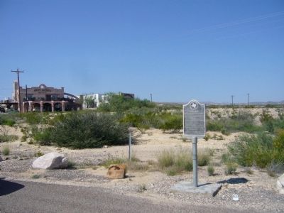
Location. 29° 19.172′ N, 103° 36.387′ W. Marker is in Terlingua, Texas, in Brewster County. Marker is at the intersection of Farm to Market Road 170 and Terlingua Ghost Town Road, on the left when traveling east on Route 170. Touch for map. Marker is in this post office area: Terlingua TX 79852, United States of America. Touch for directions.
Other nearby markers. At least 8 other markers are within 9 miles of this marker, measured as the crow flies. Terlingua Cemetery (approx. 0.4 miles away); Chisos Mine and Terlingua (approx. 0.4 miles away); Federico Villalba (approx. 0.4 miles away); Quicksilver (approx. 1.1 miles away); Ranching in the Big Bend (approx. 4.3 miles away); Big Bend Ranching: South (approx. 4.4 miles away); E.E. Townsend (approx. 6 miles away); Luna's Jacal (approx. 8.4 miles away). Touch for a list and map of all markers in Terlingua.
Credits. This page was last revised on June 16, 2016. It was originally submitted on November 4, 2012, by Bill Kirchner of Tucson, Arizona. This page has been viewed 877 times since then and 46 times this year. Photos: 1, 2. submitted on November 4, 2012, by Bill Kirchner of Tucson, Arizona. • Bernard Fisher was the editor who published this page.

