Near Midway in Barbour County, Alabama — The American South (East South Central)
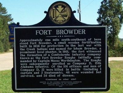
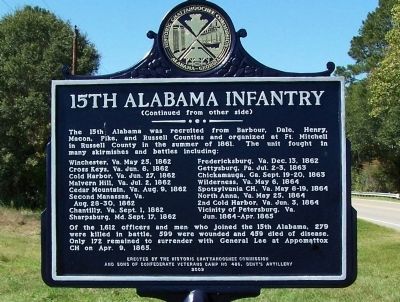
Fort Browder / 15th Alabama Infantry
Winchester, Va. May 25, 1862
Fredericksburg, Va. Dec 23, 1862
Cross Keys, Va. Jun. 8, 1862
Gettysburg, Pa. Jul. 2-5, 1863
Cold Harbor, Va. Jun. 27, 1862
Chickamauga, Ga. Sept. 19-20, 1863
Malvern Hill, Va. Jul. 2, 1862
Wilderness, Va. May 6, 1864
Cedar Mountain, Va. Aug. 9, 1862
Spotsylvania CH, Va. May 8-19, 1864
Second Manassas, Va. Aug. 28-30, 1862
North Anna, Va. May 25, 1864
Chantilly, Va. Sept. 1, 1862
2nd Cold Harbor, Va. Jun. 3, 1864
Sharpsburg, Va. Sept. 17, 1862
Vicinity of Petersburg, Va. Jun. 1864-Apr. 1865
Of the 1612 officers and men who joined the 15 Alabama, 279 were killed in battle, 599 were wounded and 459 died of disease. Only 172 remained to surrender with General Lee at Appomattox CH on Apr. 9, 1865.
Erected 2009 by Historic Chattahoochee Commission; United Daughters of the Confederacy Chapter 2669, Capt. S. H. Dent; and Sons of Confederate Veterans Camp No. 486, Dent’s Artillery.
Topics and series. This historical marker is listed in these topic lists: Forts and Castles • War, US Civil • Wars, US Indian. In addition, it is included in the Sons of Confederate Veterans/United Confederate Veterans, and the United Daughters of the Confederacy series lists. A significant day of the year for for this entry is May 31.
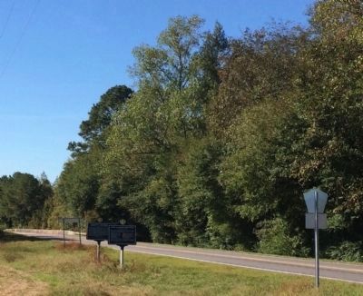
Location. 32° 0.935′ N, 85° 18.684′ W. Marker is near Midway, Alabama, in Barbour County. Marker is on U.S. 82 close to County Road 79, on the left when traveling west. Touch for map. Marker is at or near this postal address: 2475 US-82, Midway AL 36053, United States of America. Touch for directions.
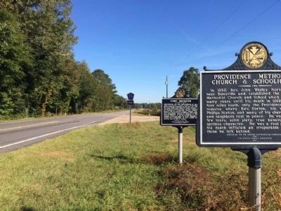
Other nearby markers. At least 8 other markers are within 8 miles of this marker, measured as the crow flies. Providence Methodist Church & Schoolhouse (here, next to this marker); a different marker also named Fort Browder / 15th Alabama Infantry (approx. half a mile away); Batesville Church - 1837 (approx. 0.6 miles away); Braxton Bragg Comer (approx. 4.1 miles away); Election Riot of 1874 (approx. 4.3 miles away); Spring Hill United Methodist Church (approx. 4.8 miles away); Eufaula-Montgomery Roadway (approx. 6.6 miles away); Ramah Baptist Church & Cemetery (approx. 8 miles away). Touch for a list and map of all markers in Midway.
Additional commentary.
1. Two markers.
There are two markers of Ft Browder, this one on Hwy 82 and one near Batesville United Methodist Church, on Woody Johnson Road, off Barbour County Road 79.
— Submitted January 13, 2021.
Credits. This page was last revised on October 17, 2022. It was originally submitted on November 5, 2012, by David J Gaines of Pinson, Alabama. This page has been viewed 3,024 times since then and 180 times this year. Last updated on October 16, 2022, by James L.Whitman of Eufaula, Alabama. Photos: 1, 2. submitted on November 5, 2012, by David J Gaines of Pinson, Alabama. 3, 4. submitted on October 19, 2014, by Mark Hilton of Montgomery, Alabama. • Mark Hilton was the editor who published this page.


