Surrey in Greater Vancouver, British Columbia — Canada’s West Coast (North America)
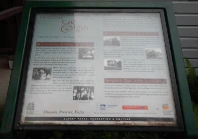
Historic Elgin
Part of Surrey’s Heritage Resources
Inscription.
Community Building
The first permanent structure in Elgin was the Elgin Hotel (1870). It was built as a convenient stop-over point for travellers between New Westminster and Blaine.
In 1875, four years before the incorporation of the District Municipality of Surrey, the first public church service was held in a simple log cabin built by John Brewer, who had settled in the area in 1870.
William Brewer is attributed with building the first community hall in 1878. Built on the banks of the Nicomekl River, it was known as ‘Misery Hall’ because at low tide you had to climb over a muddy dyke in order to reach it.
Elgin was also the site of the first commercial logging operation in Surrey. In 1875 Alexander and William McDougall started a logging camp in the Elgin area. The Nicomekl River was an essential link in towing logs to New Westminster for sale to the Royal City Planing Mills.
From 1862 to 1875 a pioneer trail was built between Semiahmoo Bay and the Fraser River at Brownsville. This wagon road was the only passable land route south from New Westminster to Blaine. In 1865, Western Union augmented this communication route when it surveyed a telegraph line which passed through Mud Bay. Where the telegraph trail crossed the Nicomekl River, near its junction with the Semaihmoo trail, a community known as Elgin emerged.
Early Residents
The first recorded homesteaders in Elgin were Hugh McDougal and Samuel Hardy in 1861. They both preempted land, built log cabins and began to clear land. However, they appear to have left by the time of Municipal incorporation in 1879.
Other early settlers in the area included William John Brewer (1870), Alexander McDougal (1872), Harry and John Chantrell (1873), Daniel Johnson (1880) John Stewart (1880), and Ed and John Loney (1890).
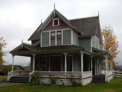
The pioneer homes evolved from simple log cabins to elegant Victorian farmhouses. Few of these historic buildings remain in Elgin today. As a consequence, the buildings that have survived are highly treasured reminders of the community’s heritage.
Historic Elgin in the 21st Century
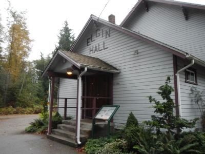
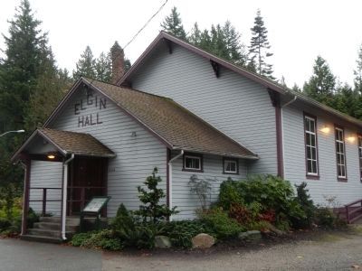
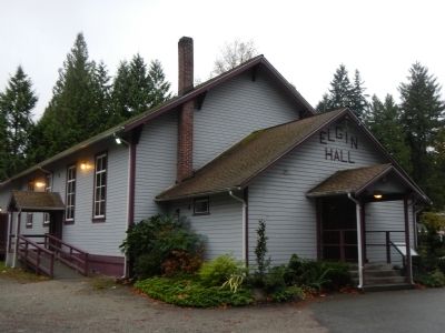
The historic buildings of Elgin include the Stewart Farm (1894-1920), the Daniel Johnson House (1904), Elgin Hall (1923), and Elgin Centre School (1921). As you visit these buildings and sites, please respect the contributions of past residents in creating these legacies. Preserved heritage symbolizes the people and community spirit of the City of Surrey.
Erected by Surrey Parks, Recreation & Culture.
Topics. This historical marker is listed in these topic lists: Notable Buildings • Settlements & Settlers. A significant historical year for this entry is 1875.
Location. 49° 4.018′ N, 122° 49.648′ W. Marker is in Surrey, British Columbia, in Greater Vancouver. Marker is at the intersection of Crescent Road and 142a Street on Crescent Road. Touch for map. Marker is at or near this postal address: 14250 Crescent Road, Surrey BC V4P, Canada. Touch for directions.
Other nearby markers. At least 8 other markers are within 18 kilometers of this marker, measured as the crow flies. The Semiahmoo Trail (approx. 0.2 kilometers away); Historic Port Elgin (approx. 0.3 kilometers away); Historic Stewart Farmhouse (approx. 1.1 kilometers away); Farming History (approx. 1.1 kilometers away); Historic McMillan Expedition (approx. 4.5 kilometers away); Peace Arch (approx. 8.9 kilometers away); Salmon! (approx. 13.8 kilometers away); The New Westminster Court House and Land Registry Office (approx. 16.3 kilometers away). Touch for a list and map of all markers in Surrey.
Credits. This page was last revised on June 16, 2016. It was originally submitted on November 6, 2012, by Barry Swackhamer of Brentwood, California. This page has been viewed 667 times since then and 20 times this year. Photos: 1, 2, 3, 4, 5. submitted on November 6, 2012, by Barry Swackhamer of Brentwood, California. • Syd Whittle was the editor who published this page.
Editor’s want-list for this marker. Photo of the Daniel Johnson House and Elgin Centre School. • Can you help?
