Oak Harbor in Island County, Washington — The American West (Northwest)
Beeksma’s Corner
City of Oak Harbor
Family Origins
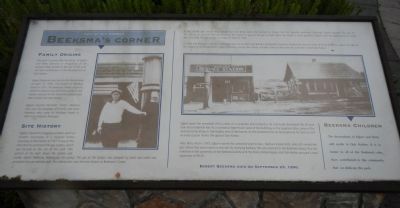
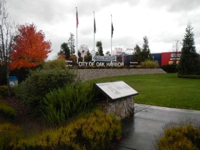
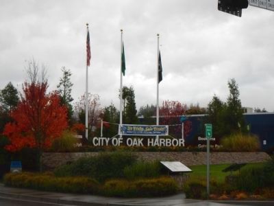
This park is named after the family of Egbert and Betty Beeksma in recognition of the business they started on the site of park and their contribution to the development of Oak Harbor.
Egbert Beeksma was born the Netherlands on April 10, 1905, and moved to Whidbey Island in 1911. The Beesma family originally settled in what is now Ault Field (north of Oak Harbor and part of the Naval Air Station) and later moved into Oak Harbor.
Egbert married Elizabeth “Betty” Nienhuis who was the daughter of Charlie and Anna Nienhuis who came to Whidbey Island in 1895 from Holland, Michigan.
Site History
Edbert, injured in a logging accident, spent six months recovering in a hospital before returning to Oak Harbor in 1927. It was at this time that he purchased the gas station, which was located on the site of this park. (The picture at the right shows the station and owner, Egbert Beeksma, leaning on the pump.) The gas at the station was pumped by hand and water was provided from an artesian well. This intersection soon became known as Beeksma’s Corner.
It was at the gas station that Egbert first met Betty when she wanted to charge her first gasoline purchase. Although Egbert pumped the gas for the vehicle, he required that she return to the station to pay for the gas in cash. Upon her return to remit payment, Egbert used the opportunity to invite her on a date. This led to their marriage on June 19, 1928.
In 1944, the Beeksmas sold the station to Allen and Barbara Vanderzicht (Barbara Vanderzicht was the sister of Betty Beeksma). Upon the sale of the station to the Vanderzicht’s, Egbert and Betty moved their family and their home to their new 40 acre farm in east Oak Harbor.
Egbert spent the remainder of his career as a carpenter and contractor. He eventually developed the 40 acres farm into residential lots. As a contractor Egbert built some of the buildings on the Seaplane Base, some of the commercial buildings in Oak Harbor, most of the homes on the residential lots he developed on his farm as well as many custom homes throughout Oak Harbor.
After Betty died in 1979, Egbert married his widowed sister-in-law, Barbara Vanderzicht, who still owned the gas station that was located on this site. By marrying Barbara, this site returned to the Beeksma family. This site remained in the ownership of the Beeksma family until the State of Washington and Oak Harbor pursued a road expansion of SR-20
Beeksma Children
The descendants of Egbert and Betty still reside in Oak Harbor. It is in honor to all the Beeksma’s who have contributed to this community that we dedicate this park.
Erected by City of Oak Harbor.
Topics. This historical marker is listed in these topic lists: Notable Places • Settlements & Settlers. A significant historical month for this entry is April 1912.
Location. 48° 17.195′ N, 122° 39.478′ W. Marker is in Oak Harbor, Washington, in Island County. Marker is at the intersection of Southwest Beeksma Drive and Southeast Pioneer Way (Washington Route 20) on Southwest Beeksma Drive. Touch for map. Marker is at or near this postal address: 1477 Southwest Beeksma Drive, Oak Harbor WA 98277, United States of America. Touch for directions.
Other nearby markers. At least 8 other markers are within 5 miles of this marker, measured as the crow flies. Flintstone Park Flagpole (approx. half a mile away); Oak Harbor's Ties to the Sea (approx. half a mile away); Oak Harbor’s Early “Town” (approx. 0.7 miles away); The Skagit, a stately society (approx. 3.4 miles away); U.S. Navy Patrol and Reconnaissance Memorial (approx. 3.8 miles away); The Jolly Boat (approx. 4.7 miles away); Zylstra Law Office (approx. 4.7 miles away); Welcome (approx. 4.7 miles away). Touch for a list and map of all markers in Oak Harbor.
Credits. This page was last revised on June 16, 2016. It was originally submitted on November 8, 2012, by Barry Swackhamer of Brentwood, California. This page has been viewed 609 times since then and 17 times this year. Photos: 1, 2, 3. submitted on November 8, 2012, by Barry Swackhamer of Brentwood, California. • Syd Whittle was the editor who published this page.


