Croom in Prince George's County, Maryland — The American Northeast (Mid-Atlantic)
The Duckett Cabin
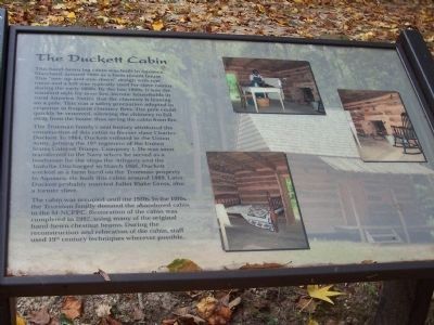
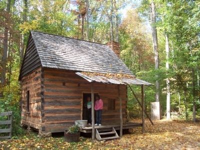
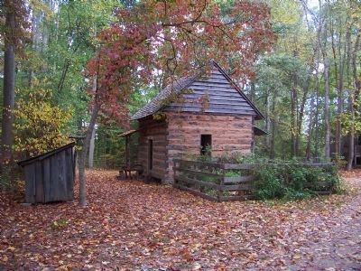
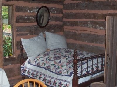
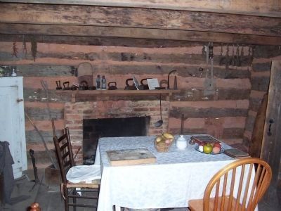
This hand hewn log cabin was built in Aquasco, Maryland around 1880 as a farm tenant house. This one up and one down design with one room and a loft was typically used for slave cabins during the early 1800s. By the late 1800s, it was the standard style for most low-income households in rural America. Notice that the chimney is leaning on a pole. This was a safety precaution adopted in response to frequent chimney fires. The pole could quickly be removed, allowing the chimney to fall away from the house, thus saving the cabin from fire.
The Trueman family's oral history attributed the construction of this cabin to the former slave, Charles Duckett. In 1864, Duckett enlisted in the Union Army, joining the 19th regiment of the United States Colored Troops, Company I. He was soon transferred to the Navy where he served as a landsman for the ships the Allegeny and the Vadalia. Discharged in March 1866, Duckett worked as a farm hand on the Trueman property in Aquasco. He built this cabin around 1880. Later, Duckett probably married Juliet Blake Cross, also a former slave.
The cabin was occupied until the 1920s. In the 1970s the Trueman family donated the abandoned cabin to the [Maryland-National Capital Parks and Planning Commission]. Restoration of the cabin was completed in 2002, using many of the original, hand-hewn chesnut beams. During the reconstruction and relocation of the cabin, staff used 19th century techniques wherever possible.
Erected by Maryland-National Capital Parks and Planning Commission.
Topics. This historical marker is listed in these topic lists: African Americans • Agriculture • Settlements & Settlers • Waterways & Vessels. A significant historical month for this entry is March 1866.
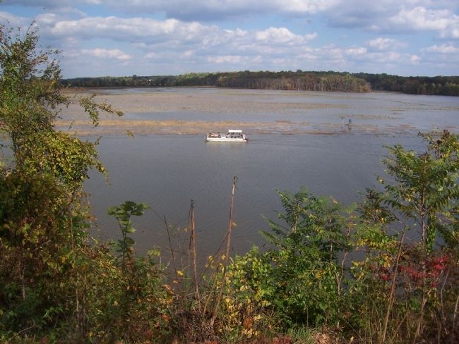
Location. This marker has been replaced by another marker nearby. It was located near 38° 46.359′ N, 76° 42.723′ W. Marker was in Croom, Maryland, in Prince George's County. Marker was on Croom Airport Road, 3.7 miles east of Croom Road (Maryland Route 382). The Duckett Cabin is part of the Patuxent Rural Life Museums complex within the Jug Bay Natural Area of Patuxent River Park. (Address: 16000 Croom Airport Road, Upper Marlboro, MD 20772.) Call park staff at 301-627-6074 to confirm hours of operation. Touch for map. Marker was in this post office area: Upper Marlboro MD 20772, United States of America. Touch for directions.
Other nearby markers. At least 8 other markers are within walking distance of this location. A different marker also named The Duckett Cabin (here, next to this marker); The Sears House (a few steps from this marker); The Blacksmith Shop (a few steps from this marker); Blown to Atoms (about 400 feet away, measured in a direct line); Climate Change and Jug Bay (about 600 feet away); Charles Town (approx. 0.7 miles away); First Americans at Mount Calvert (approx. 0.8 miles away); Mount Calvert Historical and Archaeological Park (approx. 0.8 miles away). Touch for a list and map of all markers in Croom.
More about this marker. To reach the Patuxent River Park from the Capital Beltway (I-495), take Exit 11, Pennsylvania Avenue (MD Route 4). Continue 8 miles and exit onto U.S. 301 South. Proceed 1.7 miles and make a left onto Croom Station Road. [Or, to reach this point from the John Hanson Hwy (U.S. Route 50), exit south on U.S. Route 301 and proceed south, 15 miles.]
From this point, proceed 1.6 miles on Croom Station Road and turn left onto Croom Road (MD Route 382). Proceed another 1.5 miles and make a left onto Croom Airport Road. Then proceed 2 miles to the Park entrance. Make a left and proceed 1.7 miles to the parking area. Follow foot trail to the Rural Museums.
Related marker. Click here for another marker that is related to this marker. This marker has been replaced by the linked marker.
Credits. This page was last revised on October 16, 2021. It was originally submitted on March 9, 2008, by Richard E. Miller of Oxon Hill, Maryland. This page has been viewed 3,122 times since then and 116 times this year. Photos: 1, 2, 3, 4, 5, 6. submitted on March 9, 2008, by Richard E. Miller of Oxon Hill, Maryland. • Christopher Busta-Peck was the editor who published this page.
