Coupeville in Island County, Washington — The American West (Northwest)
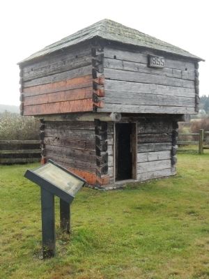
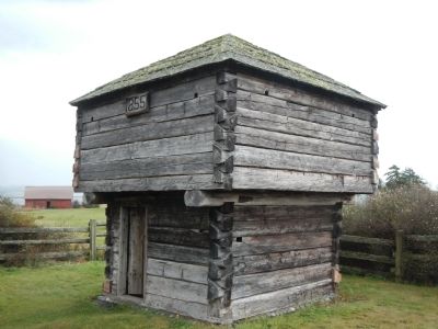
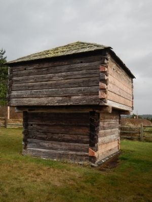
The Crockett Blockhouse

Photographed By Barry Swackhamer, October 31, 2012
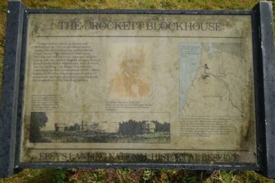
1. The Crockett Blockhouse Marker
Captions: At one time these blockhouses stood at diagonal corners of a log palisade near the Crockett homestead. It is difficult to imagine a successful defense of the farm against determined attack, but it was never put to a test. (lower, left); Col. Walter Crockett, Sr. (1786-1869). Before coming west, the Colonel fought in the war of 1812 and served three terms in the Virginia Legislature. (Center); Like most settlers, Col. Crockett came to Washington on the Oregon Trail, which ended near present-day Portland. Most newcomers were funneled into the lower Columbia and Willamette Valleys, attracted by rich farm lands. As these lands filled, settlers moved into the lands surrounding Puget Sound. The Crocketts selected this Whidbey Island claim on the advice of Issack Ebey, a fellow Missourian. (map: bottom, left).
Erected by Ebey’s Landing National Historic Reserve.
Topics. This historical marker is listed in this topic list: Forts and Castles. A significant historical year for this entry is 1855.
Location. 48° 10.397′ N, 122° 40.339′ W. Marker is in Coupeville, Washington, in Island County. Marker is on Fort Casey Road. This marker is located between South Blockhouse Road and Crockett Farm Road. Touch for map. Marker is in this post office area: Coupeville WA 98239, United States of America. Touch for directions.
Other nearby markers. At least 8 other markers are within 3 miles of this marker, measured as the crow flies. Northern Olympic Peninsula (approx. 0.9 miles away); Washington State Ferries (approx. 0.9 miles away); Ebey's Landing National Historical Reserve (approx. 0.9 miles away); Guarding the Entrance to Puget Sound – Coast Artillery Corps (approx. 1.1 miles away); Ebey Blockhouse (approx. 2.6 miles away); A Bold New Idea (approx. 2.7 miles away); Sunnyside (approx. 2.7 miles away); Mary Barrett (approx. 2.8 miles away). Touch for a list and map of all markers in Coupeville.
More about this marker. The Crockett Blockhouse is part of Ebey's Landing National Historic Reserve.
Also see . . . Crockett, Walter, Col. - Access Genealogy. After reaching Oregon Colonel Crockett directed his course to Olympia, whence, in December of 1851, he removed to W[h]idb[e]y Island, locating upon the place still owned by Walter Crockett, Jr., and upon which was built in 1857 the stockade, a view of which will be found in this work. (Submitted on November 12, 2012, by Barry Swackhamer of Brentwood, California.)
Credits. This page was last revised on June 16, 2016. It was originally submitted on November 12, 2012, by Barry Swackhamer of Brentwood, California. This page has been viewed 673 times since then and 23 times this year. Photos: 1, 2, 3, 4. submitted on November 12, 2012, by Barry Swackhamer of Brentwood, California. • Syd Whittle was the editor who published this page.


