Near Wallis in Austin County, Texas — The American South (West South Central)
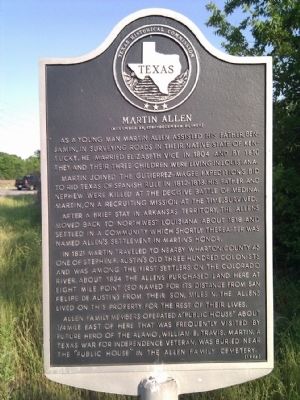
Martin Allen
(November 28, 1780 - December 30, 1837)
Martin joined the Gutierrez-Magee Expedition's bid to rid Texas of Spanish rule in 1812-1813. His father and nephew were killed at the decisive Battle of Medina. Martin, on a recruiting mission at the time, survived.
After a brief stay in Arkansas territory, the Allens moved back to northwest Louisiana about 1818 and settled in a community which shortly thereafter was named Allen's Settlement in Martin's honor.
In 1821 Martin traveled to nearby Wharton County as one of Stephen F. Austin's Old Three Hundred colonists and was among the first settlers on the Colorado River. About 1834 the Allens purchased land here at Eight Mile Point (so named for its distance from San Felipe de Austin) from their son, Miles N. The Allens lived on this property for the rest of their lives.
Allen family members operated a "Public House" about ¼ mile east of here that was frequently visited by future hero of the Alamo, William B. Travis. Martin, a Texas War for Independence veteran, was buried near the "Public House" in the Allen family cemetery.
Erected 1993 by Texas Historical Commission. (Marker Number 6344.)
Topics. This historical marker is listed in these topic lists: Settlements & Settlers • War, Texas Independence. A significant historical year for this entry is 1804.
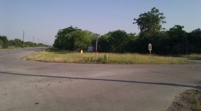
Location. 29° 40.088′ N, 96° 6.91′ W. Marker is near Wallis, Texas, in Austin County. Marker is at the intersection of 36th Division Memorial Highway (State Highway 36) and Johnston Road, on the right when traveling south on 36th Division Memorial Highway. Touch for map. Marker is in this post office area: Wallis TX 77485, United States of America. Touch for directions.
Other nearby markers. At least 8 other markers are within 4 miles of this marker, measured as the crow flies. Hartsville Cemetery (approx. 0.8 miles away); a different marker also named Hartsville Cemetery (approx. 0.9 miles away); Hartsville Veterans Memorial (approx. 0.9 miles away); Wallis Memorial Nature Park (approx. 3½ miles away); St. Paul Lutheran Church (approx. 3.7 miles away); Wallis High School (approx. 3.7 miles away); Wallis Methodist Church (approx. 3.7 miles away); Wallis Cemetery (approx. 3.9 miles away). Touch for a list and map of all markers in Wallis.
Credits. This page was last revised on June 16, 2016. It was originally submitted on November 22, 2012, by Gregory Walker of La Grange, Texas. This page has been viewed 1,429 times since then and 107 times this year. Photos: 1, 2. submitted on November 22, 2012, by Gregory Walker of La Grange, Texas. • Bernard Fisher was the editor who published this page.

