Walnut Canyon National Monument in Coconino County, Arizona — The American Mountains (Southwest)
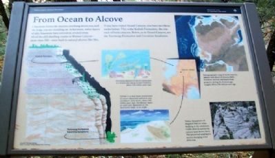
From Ocean to Alcove
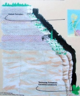
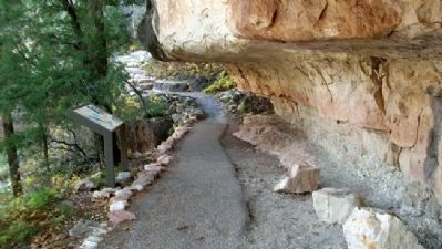
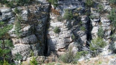
Limestone forms the massive overhang above you and the ledge you are standing on. In between, softer layers of silty limestone have retreated, eroded away. All of the cliff dwelling rooms in Walnut Canyon — more than 300 — were built in natural alcoves like this.
If you have visited Grand Canyon, you have met these rocks before. This is the Kaibab Formation, the rim rock of both canyons. Below, as in Grand Canyon, are the Toroweap Formation and Coconino Sandstone.
[Diagram and photo captions read]
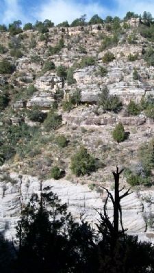
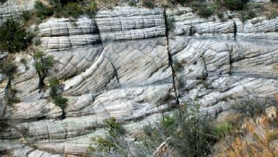
Notice the pattern of diagonal lines or cross-bedding in the sandstone visible directly across the canyon (and shown here). The preserved sand layers record changing wind direction.
——————
Formed by deposits of calcium carbonate in a shallow sea near an ancient shoreline about 250 million years ago.
——————
Formed in a near-shore environment of stream-deposited sediments and windblown sand dunes, about 265 million years ago. Windblown layers of sand were deposited on the downwind slope, at an angle.
——————
Paleogeographic map of North America with detail of Arizona. Northern Arizona had beach front property during the Permian age, roughly 286 to 248 million years ago.
Erected by National Park Service.
Topics. This historical marker is listed in these topic lists: Environment • Native Americans.
Location. 35° 10.125′ N, 111° 30.661′ W. Marker is in Walnut Canyon National Monument, Arizona, in Coconino County. Marker is along the Island Trail loop, only accessible from the visitor center. Touch for map. Marker is at or near this postal address: 3 Walnut Canyon Road, Flagstaff AZ 86004, United States of America. Touch for directions.
Other nearby markers. At least 8 other markers are within walking distance of this marker. Room Functions (within shouting distance of this marker); A Days Work (within shouting distance of this marker); The Quest for Water (about 300 feet away, measured in a direct line); Problem Solving (about 400 feet away); An Efficient Design (about 400 feet away); The Perfect Shelter (about 600 feet away); A Community Sharing the Land (about 600 feet away); What Happened Here? (about 600 feet away). Touch for a list and map of all markers in Walnut Canyon National Monument.
Also see . . . Walnut Canyon National Monument. (Submitted on November 24, 2012, by William Fischer, Jr. of Scranton, Pennsylvania.)
Credits. This page was last revised on June 16, 2016. It was originally submitted on November 24, 2012, by William Fischer, Jr. of Scranton, Pennsylvania. This page has been viewed 571 times since then and 17 times this year. Photos: 1, 2, 3, 4, 5, 6. submitted on November 24, 2012, by William Fischer, Jr. of Scranton, Pennsylvania.
