St. Michaels in Talbot County, Maryland — The American Northeast (Mid-Atlantic)
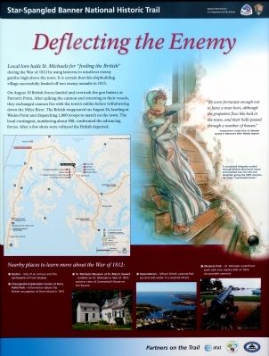
Deflecting the Enemy
Star-Spangled Banner National Historic Trail
— National Park Service, U.S. Department of the Interior —
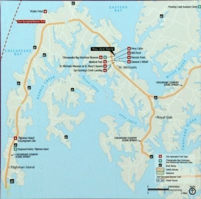
On August 10 British forces landed and overtook the gun battery at Parrot's Point. After spiking the cannon and returning to their vessels, they exchanged cannon fire with the town's militia before withdrawing down the Miles River. The British reappeared on August 26, landing at Wades Point and dispatching 1,800 troops to march on the town. The local contingent, numbering about 500, confronted the advancing forces. After a few shots were volleyed the British departed.
"We were fortunate enough not to have a man hurt, although grapeshot flew like hail in the town, and their balls passed through a number of houses." -- Excerpted from a letter from St. Michaels quoted in Baltimore's Niles' Weekly Register
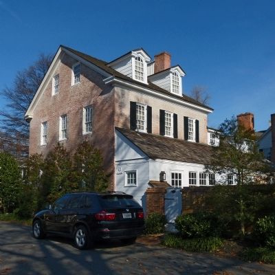
A cannonball allegedly crashed through William Merchant's house and bounced near his wife and daughter, giving the 1805 structure the name "Cannonball House."
Nearby places to learn more about the War of 1812:
* Easton -- site of an armory and the earthworks of Fort Stoakes
* Chesapeake Exploration Center at Ferry Point Park -- information about the British occupation of Kent Island in 1813
* St. Michaels Museum at St. Mary's Square -- Exhibits on St. Michaels in War of 1812; exterior view of Cannonball House on the Square
* Queenstown -- Where British approached by land and water in a surprise attack
* Muskrat Park -- St. Michaels waterfront park with two replica War of 1812 six-pounder cannons
Erected by National Park Service, U.S. Department of the Interior.
Topics and series. This historical marker is listed in this topic list: War of 1812. In addition, it is included in the Star Spangled Banner National Historic Trail series list. A significant historical year for this entry is 1812.
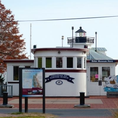
Location. 38° 47.236′ N, 76° 13.234′ W. Marker is in St. Michaels, Maryland, in Talbot County. Marker can be reached from Cherry Street. On the waterfront promenade in front of the Chesapeake Bay Maritime Museum. Touch for map. Marker is at or near this postal address: 213 North Talbot Street, Saint Michaels MD 21663, United States of America. Touch for directions.
Other nearby markers. At least 8 other markers are within walking distance of this marker. War in the Chesapeake (here, next to this marker); Oystering on the Chesapeake (here, next to this marker); What's under your feet? (here, next to this marker); Freedom's Figurehead (a few steps from this marker); Navy Point Historic Houses (a few steps from this marker); Lost Overboard (within shouting distance of this marker); A Mighty Pull (within shouting distance of this marker); Skipjack Centerboard (within shouting distance of this marker). Touch for a list and map of all markers in St. Michaels.
Credits. This page was last revised on November 1, 2020. It was originally submitted on November 26, 2012. This page has been viewed 614 times since then and 13 times this year. Last updated on October 25, 2020, by Carl Gordon Moore Jr. of North East, Maryland. Photos: 1, 2, 3. submitted on November 26, 2012, by Allen C. Browne of Silver Spring, Maryland. 4, 5. submitted on January 27, 2013, by Allen C. Browne of Silver Spring, Maryland. • J. Makali Bruton was the editor who published this page.
