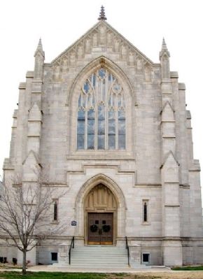
Independence in Montgomery County, Kansas — The American Midwest (Upper Plains)
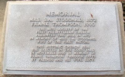
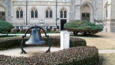
Stoddard - Thompson Memorial Bell
Mrs. S.A. Stoddard, 1872; Frank Thompson, 1990
Erected 1990 by Lucy Thompson and Friends.
Topics and series. This historical marker is listed in these topic lists: Churches & Religion • Communications • Women. In addition, it is included in the Historic Bells series list. A significant historical month for this entry is November 1990.
Location. 37° 13.303′ N, 95° 42.254′ W. Marker is in Independence, Kansas, in Montgomery County. Marker is at the intersection of 5th Street and Maple Street, on the right when traveling south on 5th Street. Touch for map. Marker is at or near this postal address: 201 South 5th Street, Independence KS 67301, United States of America. Touch for directions.
Other nearby markers. At least 8 other markers are within 2 miles of this marker, measured as the crow flies. Etchen Studebaker Sales & Service (about 500 feet away, measured in a direct line); Princess Cartwright's "Remington" (approx. 0.3 miles away); Replica of the Statue of Liberty (approx. 0.4 miles away); F-100F Super Sabre (approx. one mile away); A. C. Stich Memorial (approx. one mile away); Kayo's Boys (approx. 1.2 miles away); United Spanish War Veterans Memorial (approx. 1.2 miles away); Veterans Memorial (approx. 1.3 miles away). Touch for a list and map of all markers in Independence.
Also see . . . History of First Presbyterian Church, Independence KS. (Submitted on November 27, 2012, by William Fischer, Jr. of Scranton, Pennsylvania.)
Credits. This page was last revised on September 7, 2020. It was originally submitted on November 27, 2012, by William Fischer, Jr. of Scranton, Pennsylvania. This page has been viewed 434 times since then and 11 times this year. Photos: 1, 2, 3, 4, 5. submitted on November 27, 2012, by William Fischer, Jr. of Scranton, Pennsylvania.
