Orleans in Barnstable County, Massachusetts — The American Northeast (New England)
Battle of Orleans Massachusetts 1814
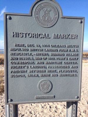
Here, Dec. 19, 1814 Orleans Militia repulsed British landing from H.M.S. Newcastle, - intent; burning village and vessels, War of 1812. Town's early commercial and maritime center. Packet's Landing; passengers and freight between here, Plymouth, Boston, Salem, Maine and maritimes.
Erected 1976 by American Revolution Bicentennial.
Topics. This historical marker is listed in this topic list: War of 1812. A significant historical date for this entry is December 19, 1814.
Location. 41° 47.988′ N, 70° 0.507′ W. Marker is in Orleans, Massachusetts, in Barnstable County. Marker is on Bay View Drive, 0.1 miles west of Rock Harbor Road. Touch for map. Marker is at or near this postal address: Rock Harbor Landing, Orleans MA 02653, United States of America. Touch for directions.
Other nearby markers. At least 8 other markers are within 2 miles of this marker, measured as the crow flies. Commemorating the Battle of Rock Harbor (here, next to this marker); Coast Guard Motor Life Boat CG36500 (a few steps from this marker); The Whale of Orleans (approx. 1.2 miles away); French–Atlantic Cable Company (approx. 1.3 miles away); The French Transatlantic Telegraph Cable, 1898 (approx. 1.3 miles away); Jonathan Young Mill (approx. 1.4 miles away); Origins of Orleans (approx. 1.4 miles away); Orleans’ First Resident? (approx. 1.4 miles away). Touch for a list and map of all markers in Orleans.
Credits. This page was last revised on September 2, 2021. It was originally submitted on January 1, 2012, by Rod Funston of Eastham, Massachusetts. This page has been viewed 1,149 times since then and 23 times this year. Last updated on November 29, 2012, by Rod Funston of Eastham, Massachusetts. Photo 1. submitted on January 1, 2012, by Rod Funston of Eastham, Massachusetts. • Bill Pfingsten was the editor who published this page.
Editor’s want-list for this marker. A wide shot of the marker and its surroundings. • Can you help?
